The Lost Legacy of Bugis Cartography

Recently, Sabri Zain’s Malayan History Society shared an intriguing artefact—the Bugis nautical chart known as “Boeginese zeekaart van de Indische Archipel” (Bugis sea chart of the Indian Archipelago). This sparked quite a stir among history enthusiasts, as Bugis maritime maps are an exceedingly rare glimpse into indigenous seafaring knowledge of the Nusantara.
Only five such maps are known to scholars. Tragically, three have been lost to time. The “Boeginese zeekaart” posted by Sabri is housed at the Utrecht University Library in the Netherlands, its origins dating back to the early 19th century (there is a discussion about its age at Sabri’s post).
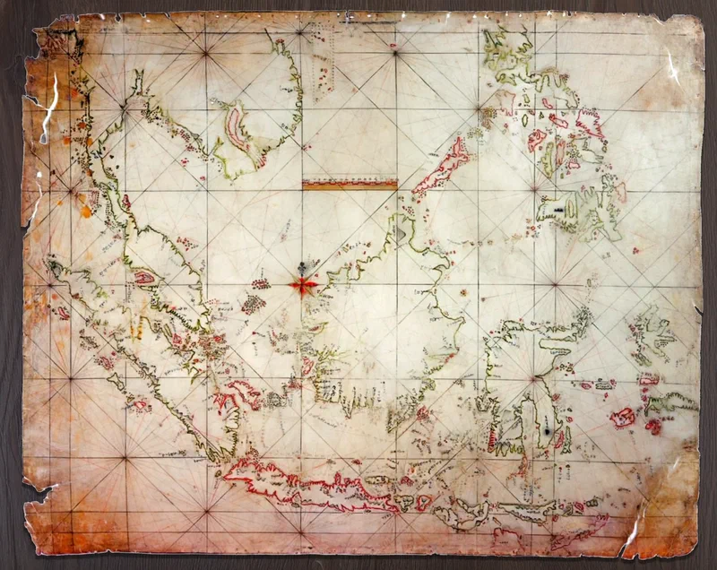
Posted here is the lesser-known, and the only other Bugis map that is not lost, inaccurately labelled by the Spanish museum authorities as “Carta Indigena Filipina” (Indigenous Map of the Philippines). It was found “contained inside a bamboo tube taken from the breastwork of a Moro pirate ship captured near the waters of the Sulu archipelago”. The chart “was drafted
in ink on cowhide, with highlights in various colors. It measures approximately 72 by 90 centimeters”. It found its way to Spain in 1847 and is now kept at the Archivo del Museo Naval in Madrid.
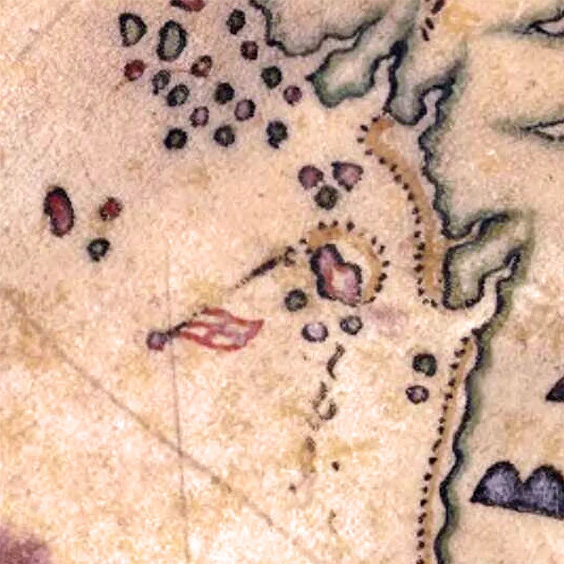
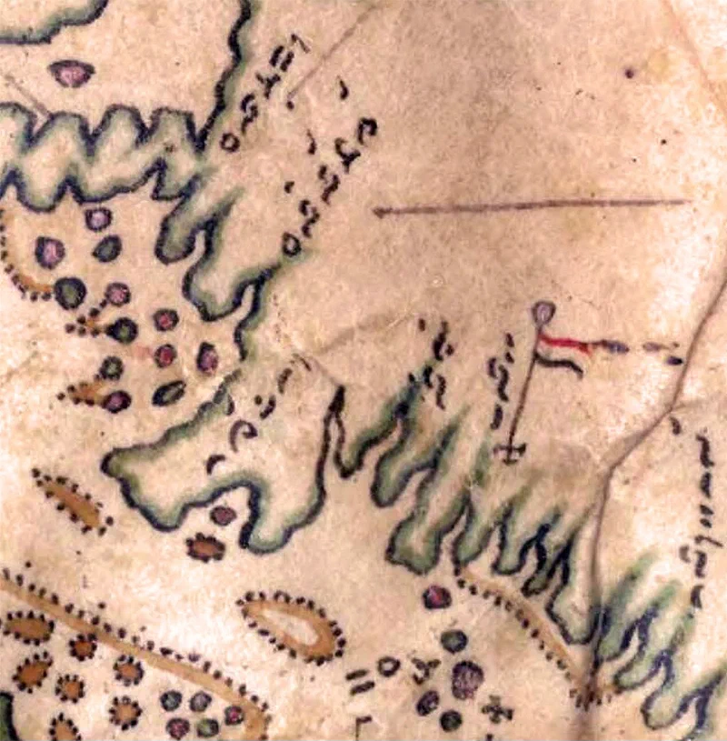
The names of the historic ports of Penang and Melaka are written in Lontara script - a syllabic writing system created by the Bugis. Their phonetic transliterations read as Pulopina (Pulau Pinang) and Malaka (Melaka). Other place names in the Straits of Malacca of interest are Basare (Pulau Besar, Melaka), Muwara (Muar) and Johoro (Johor)*.
Source:
- Aditya Bayu Perdana & Muhammad Buana (2022), “Sea of Names: Spatial and Toponymic Translations in the 19th Century Bugis Maps of the Malay Archipelago”, Published in Translation: Southeast Asian Movement Publication, Issue 01, Fall 2022.
- Aditya Bayu Perdana (2023), “Islands, maps, and Lontara’: Bugis counter-mapping on a nineteenth-century map of Nusantara”, Published in Wacana Journal of the Humanities of Indonesia, October 2023
- Nasser S. Sharief (2023), “The Iranūn And Philippines’ Historical Claims In The South China Sea - The binding tie of place, meaning, and memory”