Pulpina (Pulau Pinang) in a Portuguese map (1519)

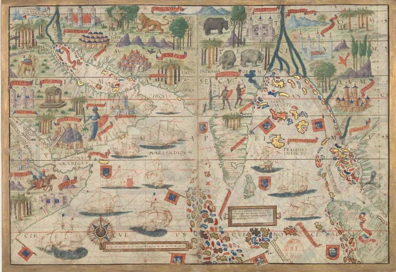
The earliest known European depiction* of Pulau Pinang (Penang Island) is found in a richly illuminated chart made for Manuel I of Portugal, just 8 years after the capture of Malacca by Albuquerque, known today as the Miller Atlas. This cartographic treasure is kept in the National Library of France which acquired it from Emmanuel Miller in 1897.
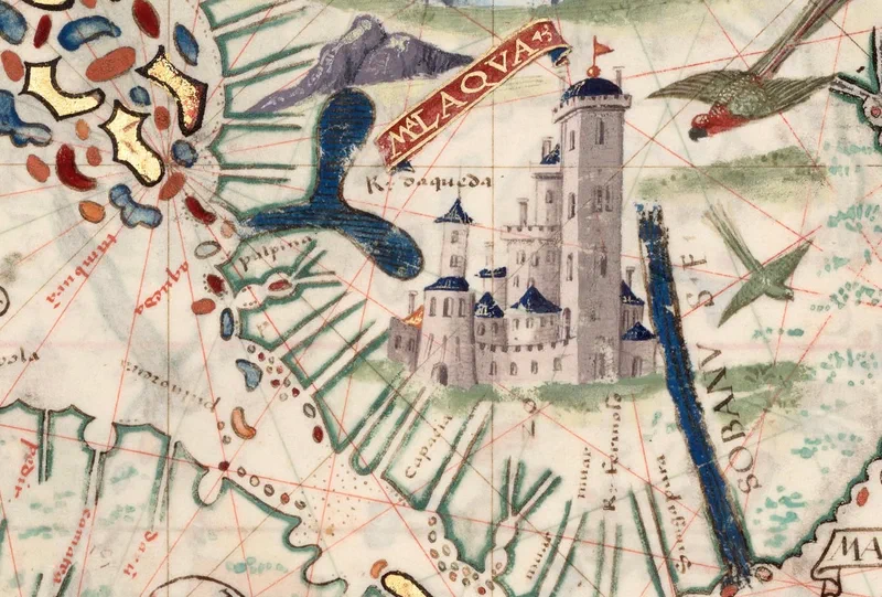
In this excerpt, “Pulpina” (Pulau Pinang) lies off the coast near “Rio daqueda,” the River of Kedah. Inland is a body of water that may be the Sungai Merbok estuary, and beside it a mountain with the unmistakable profile of Gunung Jerai.
To the south is a detailed imagined drawing of a European style fortified city named Malaqva (Melaka). And at the very tip of the Malay Peninsula, already named on the chart: “Simgapura.”
Sources:
- Atlas nautique du Monde, dit atlas Miller] ; 2-5. [Atlas Miller : feuilles 2 à 5 . feuille 3, Homem, Lopo. Cartographe (incertain.e). Ref: ark:/12148/btv1b55002605w, Bibliothèque nationale de France.
- Nautical Atlas of the World, Folio 3 Recto, Northern Indian Ocean with Arabia and India and Folio 3 Verso, Southern Indian Ocean with Insulindia on the Left, and Madagascar on the Right. Ref:https://hdl.loc.gov/loc.wdl/wdl.18559, Library of Congress
*The only earlier mention of the name Pulau Pinang is from Admiral Zheng He’s (Cheng Ho) 15th century chart, which was however only published in 1621 as part of Wubei Zhi (武備志, Treatise on Armament Technology or Records of Armaments and Military Provisions).