Atlas Vallard – Straits of Malacca and Borneo (1547)
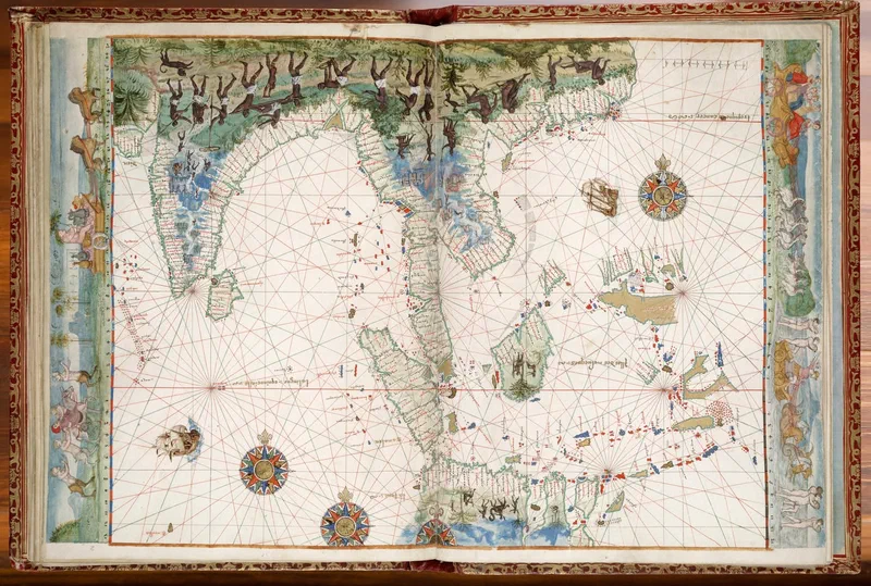
This gorgeous chart showing the East Indies – from India to the spice islands of the Moluccas (Maluku) – is from a French-made portolan atlas made in 1547.
This “extravagantly illuminated" compilation became known as the Vallard Atlas after Nicolas Vallard de Dieppe who “was probably not the cartographer, but the first owner”. The cartographers of the Dieppe school include Jean Rotz, Pierre Desceliers, and Guillaume le Testu. However, the identity of the creator of the chart is not known with certainty and is thought to be “possibly by a Portuguese cartographer or based on a Portuguese prototype”. The current owner of the atlas is the Huntington Library; it was acquired by its namesake Henry E. Huntington in 1924.
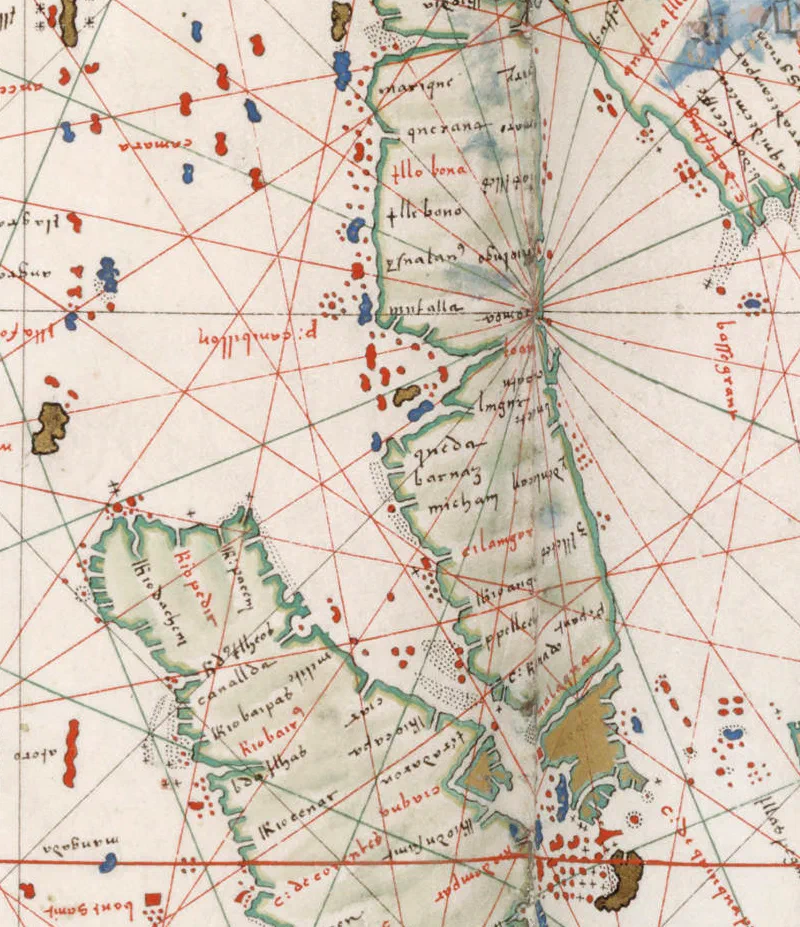
Major ports of call along the Straits of Malacca that can be identified include Queda (Kedah), Barnaz (Beruas), Cilangor (Selangor), P. Pellech (Pulo Perak - Perak is often depicted as an island in early charts), C. Rachael (Tanjung Tuan), Malaqua (Melaka), Capo de quinquapura (Singapura) – the promontory at the tip of Asia – Ptolemy’s mysterious Malæi Colon. A curious feature is that “North is oriented towards the bottom of the page and the South is at the top” which is “a habit of Muslim cartographers but this practice was quite rare in Christian Europe”. [1]
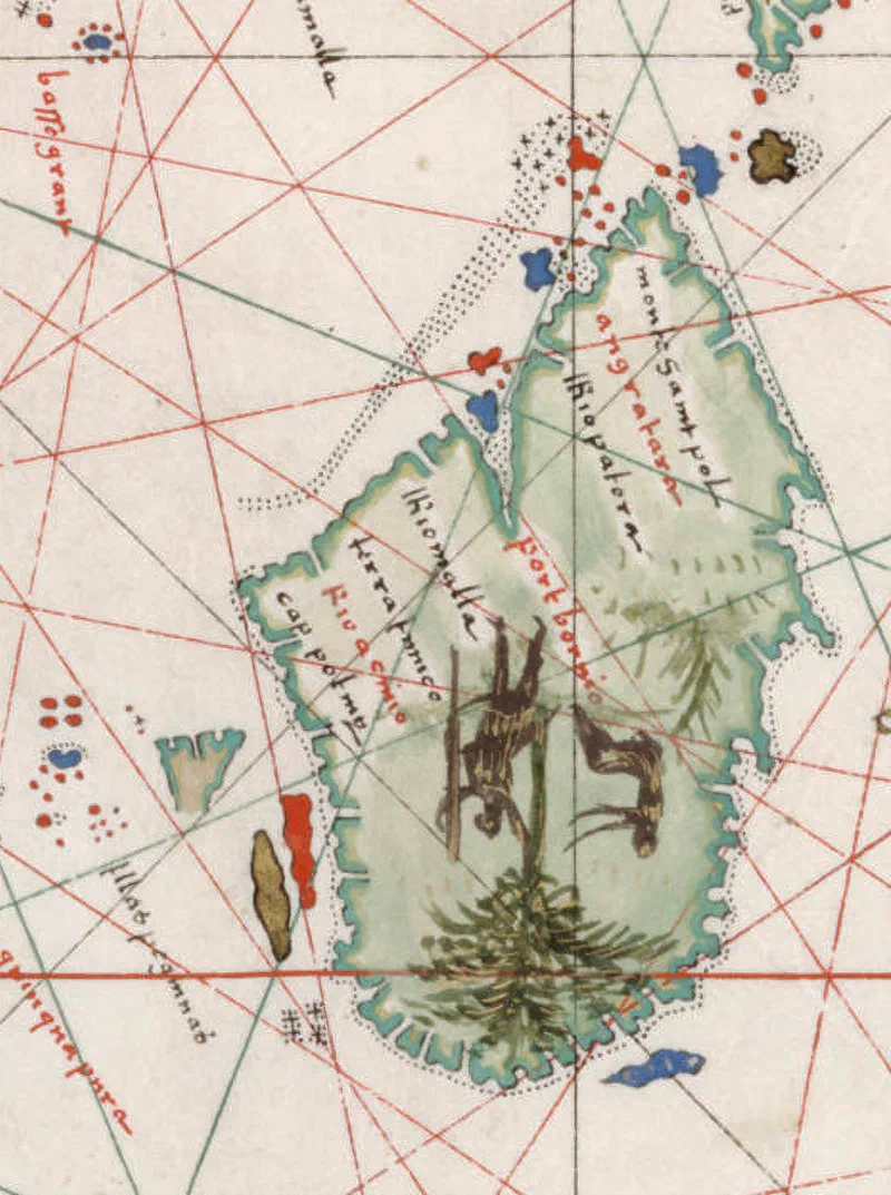
A curious but common feature of this time is the penarikan route which is shown as a sea passage cutting across the peninsula, located south of Melaka at Muar. This particular chart swapped the position of Selangor and Perak. Pulau Pangkor and the Pulau Sembilan islands at Perak are shown in the chart incorrectly as located at Selangor and the island marked in blue beside Kedah is likely Pulau Pinang (Penang Island). The island of Borneo is depicted with the place on it named “port bornio”.
[1] This post shows the chart upside down resulting in the familiar orientation of North at the top.
Sources:
- Thomas Suarez (2012), “Early Mapping of Southeast Asia”
- Portolan atlas : [cartographic material] : [manuscript], 1547. Call Number: mssHM 29. The Huntington Library
- S.A.M. Moleiro (2008), Atlas Vallard, University of Michigan Online Exhibition, Accessed: https://apps.lib.umich.edu/online-exhibits/exhibits/show/india-maps/item/5220?exhibit=136&page=1118&return=2968