An Early Plan of Pulo Peenang or Prince of Wales's Island (1788)

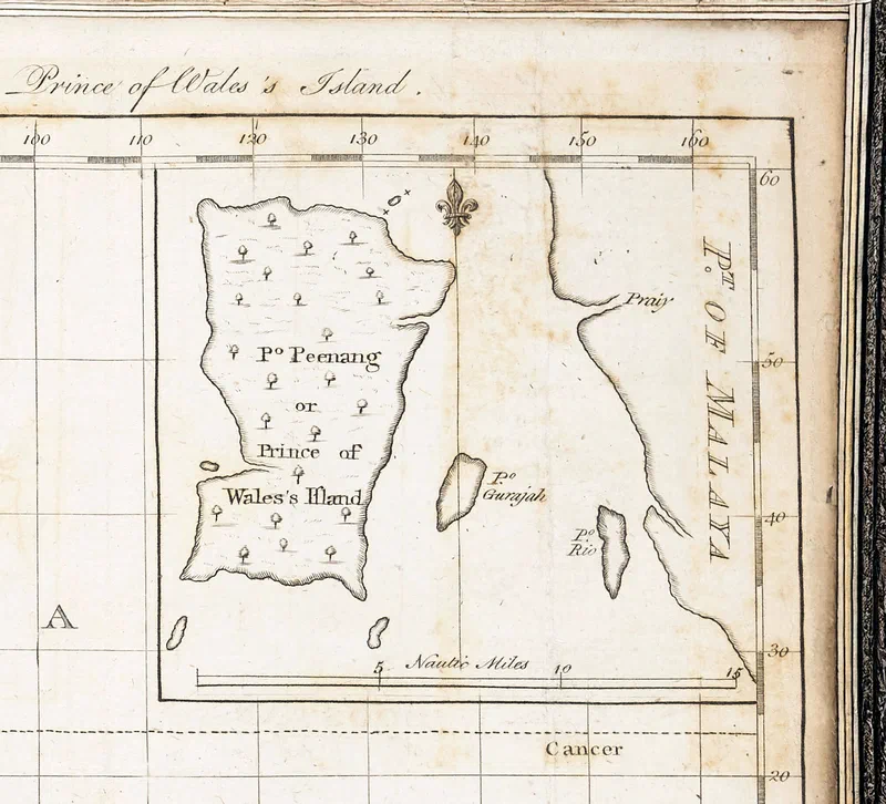
This early map of Penang was published on 25 March 1788 by the English publisher John Stockdale, whose shop stood “opposite Burlington-House” at Piccadilly, London. Issued just less than two years after Francis Light took possession of the island, it depicts the surrounding islands of Pulau Tikus, Pulau Kendi, Pulau Rimau, Pulau Betong, Pulau Jerejak and Pulau Kra (now Pulau Aman) in roughly their correct positions relative to the main island.
Only three islands are named on the map: Pulo Peenang – a phonetic rendering of the Malay pronunciation – Pulo Gerajah (Pulau Jerejak), and Pulo Rio, likely a misheard version of Pulau Kra. On the Kedah mainland opposite Penang Island appears the label Point of Malaya – probably intended to mean the Peninsula. Two rivers are also marked: Sungai Jawi (unlabelled) and Sungai Prai, here spelt “Praiy”.
In these early years, Penang was also known as Prince of Wales’s Island – note the double-s possessive in “Wales’s”, a style of the period also used by Francis Light in his own documents.
Source:
Extracted from an inset of “A general chart of the Atlantic and Indian oceans with the situation & plan of Pulo Peenang or Prince of Wales’s Island”, published 1788.