Merdeka spirit on Penang Road

Merdeka spirit on display at Penang Road today.🇲🇾
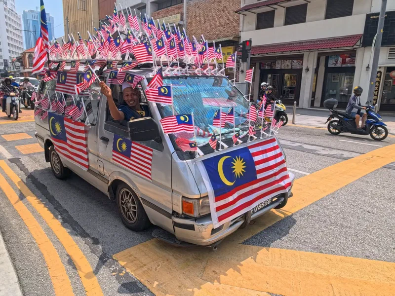
Merdeka spirit on display at Penang Road today.🇲🇾
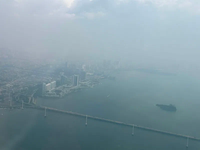
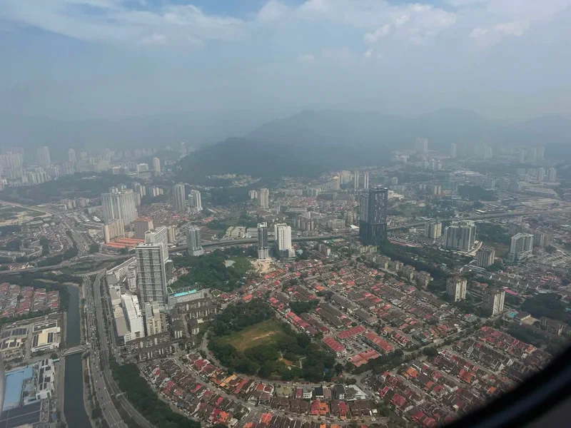
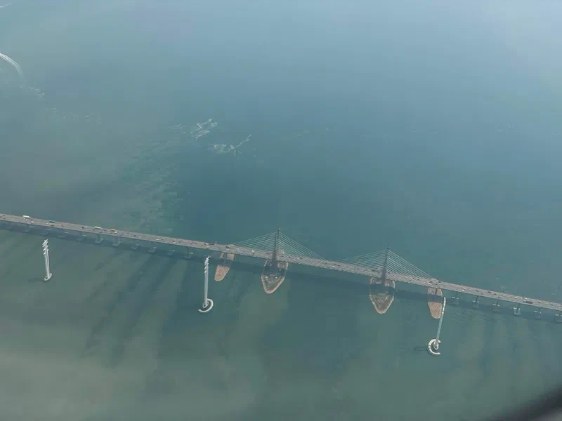
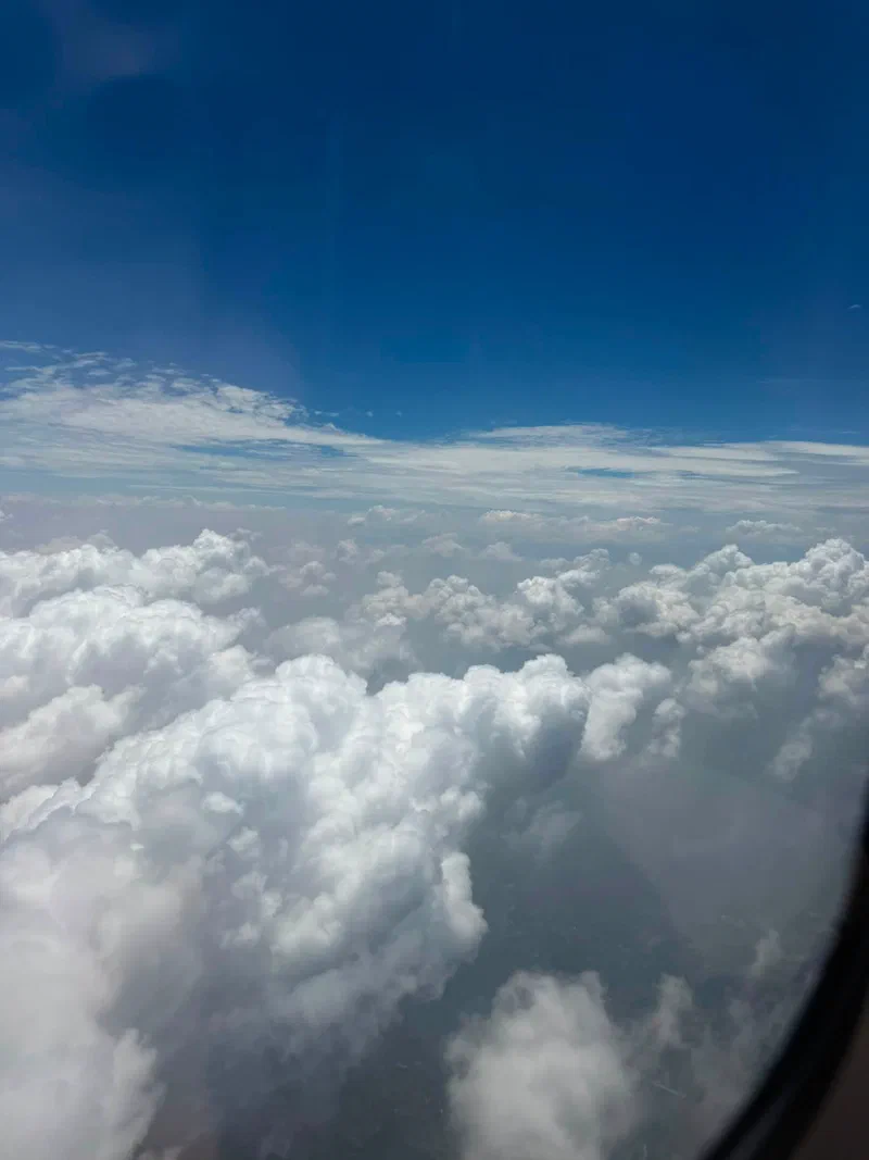
The haze shrouding Penang this morning as seen from the air. Just above the cloud cover – blue skies.
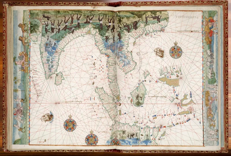
This gorgeous chart showing the East Indies – from India to the spice islands of the Moluccas (Maluku) – is from a French-made portolan atlas made in 1547.
This “extravagantly illuminated" compilation became known as the Vallard Atlas after Nicolas Vallard de Dieppe who “was probably not the cartographer, but the first owner”. The cartographers of the Dieppe school include Jean Rotz, Pierre Desceliers, and Guillaume le Testu. However, the identity of the creator of the chart is not known with certainty and is thought to be “possibly by a Portuguese cartographer or based on a Portuguese prototype”. The current owner of the atlas is the Huntington Library; it was acquired by its namesake Henry E. Huntington in 1924.
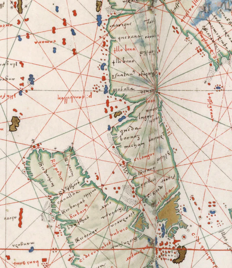
Major ports of call along the Straits of Malacca that can be identified include Queda (Kedah), Barnaz (Beruas), Cilangor (Selangor), P. Pellech (Pulo Perak - Perak is often depicted as an island in early charts), C. Rachael (Tanjung Tuan), Malaqua (Melaka), Capo de quinquapura (Singapura) – the promontory at the tip of Asia – Ptolemy’s mysterious Malæi Colon. A curious feature is that “North is oriented towards the bottom of the page and the South is at the top” which is “a habit of Muslim cartographers but this practice was quite rare in Christian Europe”. [1]
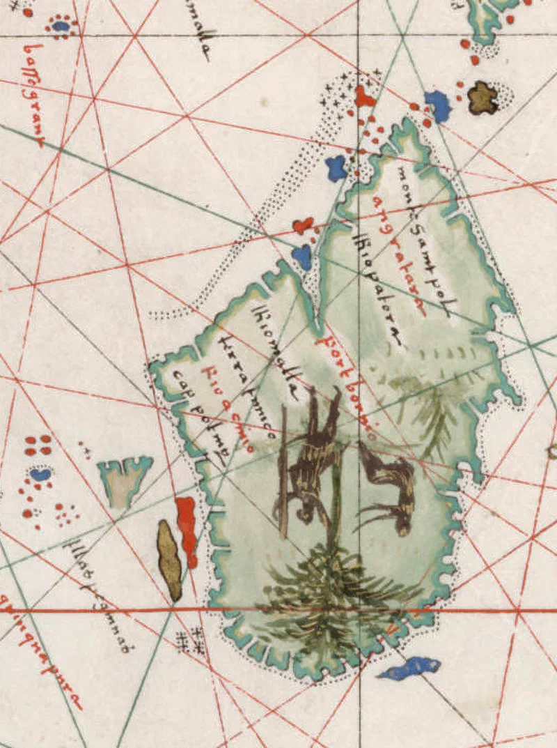
A curious but common feature of this time is the penarikan route which is shown as a sea passage cutting across the peninsula, located south of Melaka at Muar. This particular chart swapped the position of Selangor and Perak. Pulau Pangkor and the Pulau Sembilan islands at Perak are shown in the chart incorrectly as located at Selangor and the island marked in blue beside Kedah is likely Pulau Pinang (Penang Island). The island of Borneo is depicted with the place on it named “port bornio”.
[1] This post shows the chart upside down resulting in the familiar orientation of North at the top.
Sources:
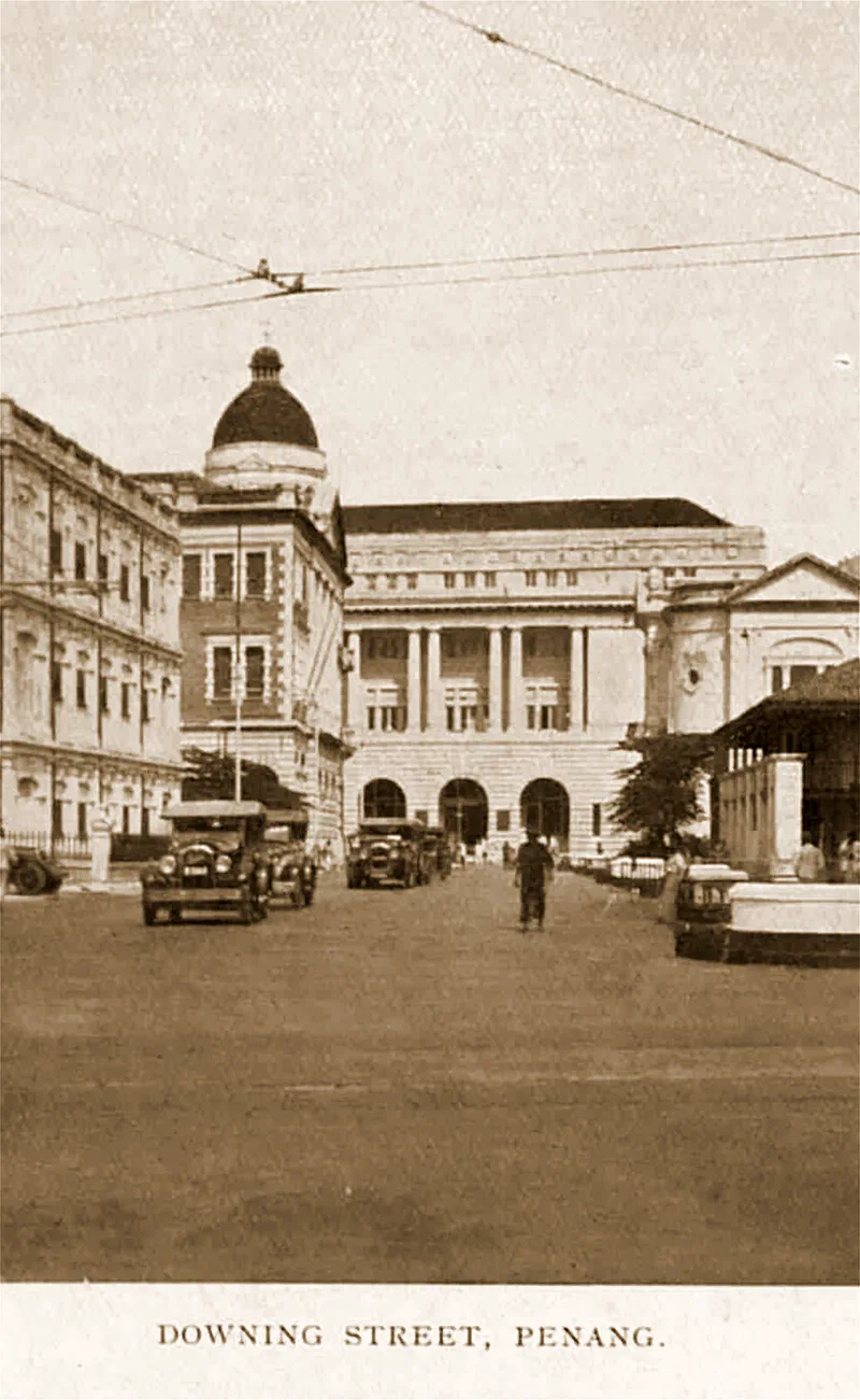
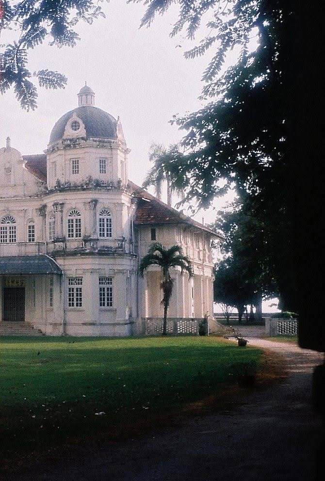
The characteristic dome of Lim Lean Teng’s Woodville mansion at Northam Road (right photo) is an echo of a lost George Town architectural landmark. He “wanted a mansion with a dome like that of the former Hongkong and Shanghai Bank building” at the junction of Downing Street and Beach Street (left photo from 1936). The architect Charles Miller delivered his vision.
Source:
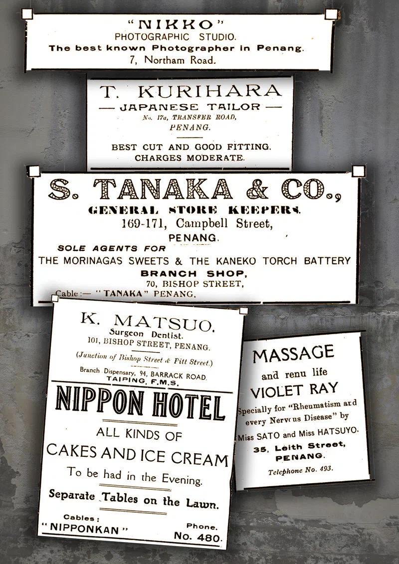
This selection of advertisements from Japanese-run businesses in Penang comes from the June 1924 edition of the ‘Illustrated Guide to Penang’ published by the Passengers’ Information Bureau.
The local Japanese community ran a wide variety of enterprises, including Tanaka’s general store, which was the sole distributor of Morinaga’s sweets and was located on Campbell Street with a branch on Bishop Street, alongside the well-regarded Nikko photo studio, Kurihara’s tailoring service and the Nippon Hotel.
Health and wellness were also well covered, featuring Matsuo’s dental surgery, as well as a massage and ‘violet ray’ (ultraviolet light) service offered by Ms. Sato and Ms. Hatsuyo, who promised to ‘renu life’ and to ‘cure rheumatism and every Nervous’ ailment.
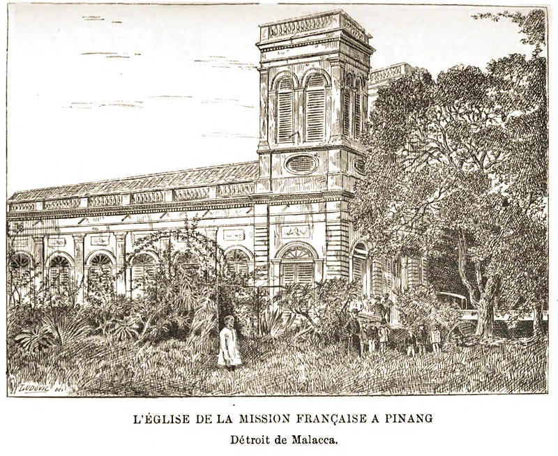
The Church of the Assumption on Farquhar Street recently celebrated its 240th anniversary, having been founded in 1786.
This engraving, entitled “The Church of the French Mission at Pinang, Straits of Malacca”, was made from a photograph taken by the French explorer and economist Brau de Saint-Pol Lias, who visited Penang in 1880. He described the scene in his travel memoir De France à Sumatra par Java, Singapour et Pinang (From France to Sumatra by way of Java, Singapore and Penang), published in 1884:
“Beyond the mercantile quarters of the town, which fringe the beach, the Mission-house – like most of the villas of the European merchants, who repair thither of an evening, to a shaded home, for coolness and quiet after a hot and toilsome day – stands amid gardens of green lawn, planted about with flowering shrubs. The church, close by, is built of masonry. The porch (as may be seen in the photograph) lies sheltered beneath great trees, in whose shade the jalousied carriages draw up during divine service.”
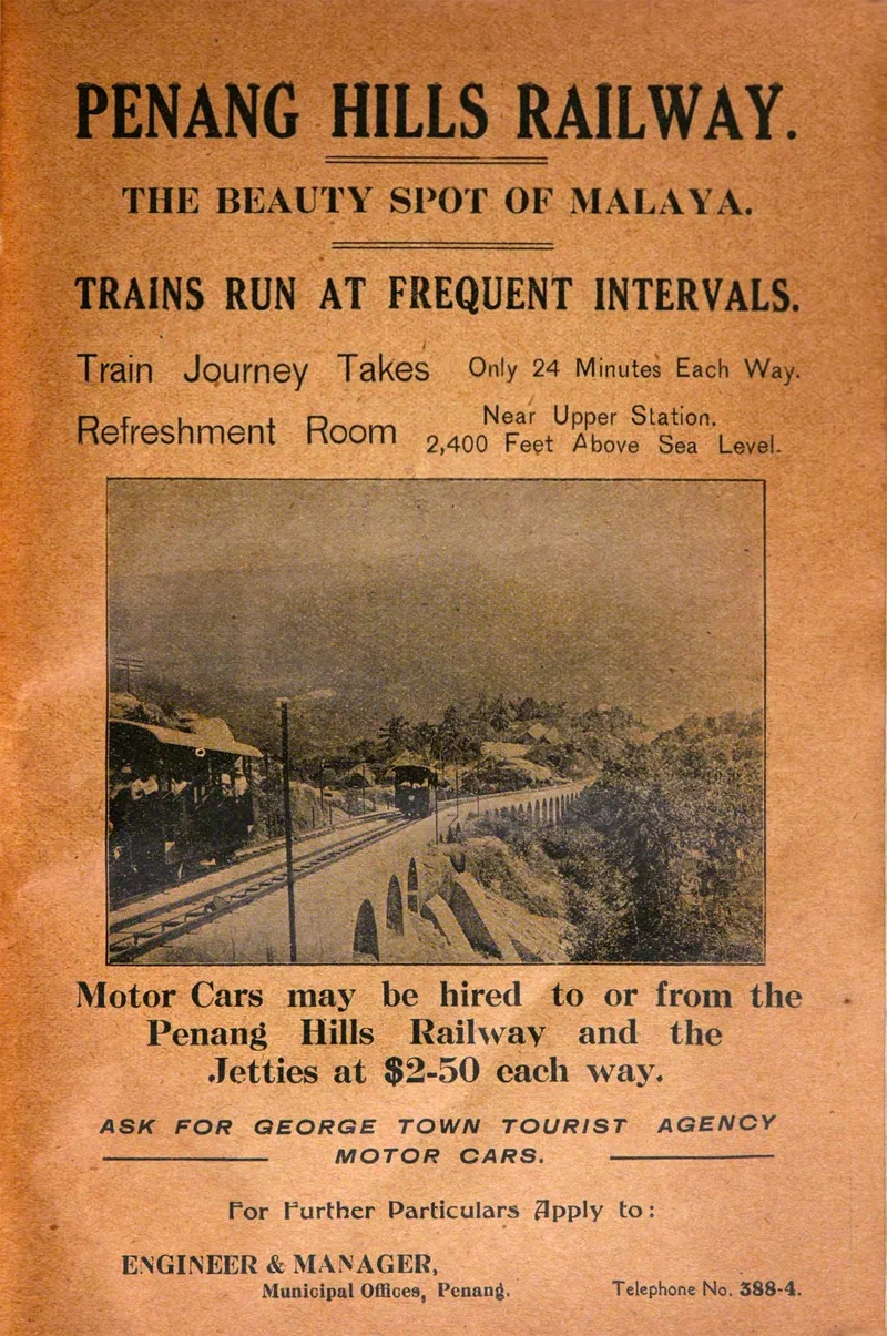
An early advertisement for Penang Hills Railway – then less than 8 months old – found in the June 1924 edition of the “Illustrated Guide to Penang” issued by the Passengers’ Information Bureau (PIB) which was distributed at Swettenham Pier to visitors disembarking at Penang.
PIB was, in fact, a tour agency run by David Fraser Laing. The guidebook repeatedly advertises that car hire could be arranged through it, and the Bureau appears to have had a working arrangement with the Penang Central Motor Garage (PCMG) – part owned by Tan Chin Swee – since it gives its headquarters as No. 5 Farquhar Street, the same premises as PCMG.
Sources:
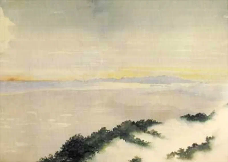
Bukit Larut – known in colonial times as Maxwell Hill – feels a world away from Penang. Yet on a clear day, these two hill stations are within sight of each other.
A watercolour by Frank Swettenham, painted around 1884* from ‘The Cottage’ at Maxwell Hill, above Taiping, shows exactly this. Looking north-west across some 80 km of the Penang Strait, he depicts Pulau Kra (today Pulau Aman), Pulau Gedung and Pulau Jerejak, with the whole eastern flank of Pulau Pinang rising behind them.
Source:
* Around this time Swettenham was Resident of Selangor. He would go on to become Resident-General of the Federated Malay States (1896) and Governor of the Straits Settlements (1901).
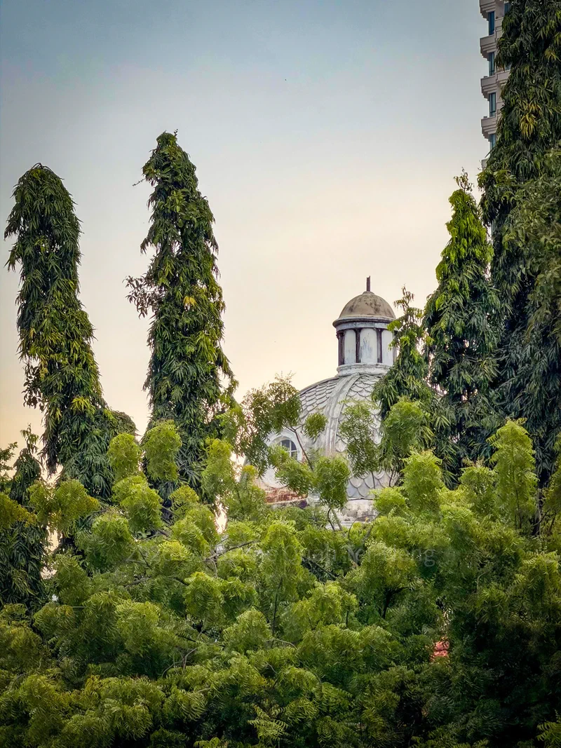
A scene from Rome or Florence, Italy? Actually, it’s Penang.
The building with its elegant dome is Woodville, the famed mansion of Lim Lean Teng – seen here from the car park of Northam Beach Cafe. For his 1925 villa, Lim wanted a dome to rival the Hongkong and Shanghai Bank on Beach Street (since replaced by the current domeless building), and his architect, Joseph Charles Miller of the firm Stark & McNeill, delivered his dream home with style and polish. Lim moved in on Saturday, 18 February 1928, with a grand house-warming reception lasting three days. The garden was thrown open to the public, and “Chinese wayang were performed afternoon and evening.”
Sources: