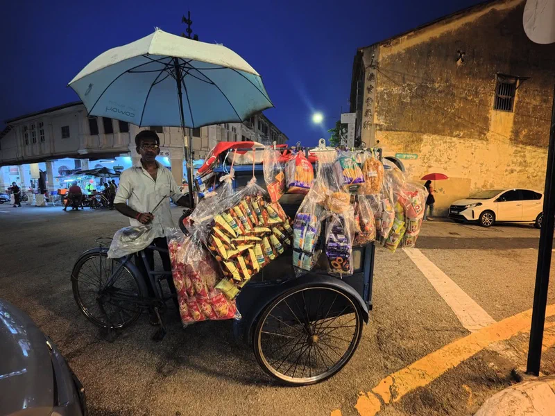
A traditional roti man (mobile bread vendor) works his rounds along Gat Lebuh Melayu on the familiar George Town trishaw modified for the trade – the passenger seats replaced by a bread box, and a variety of snacks bagged in plastic and hung from the sides.
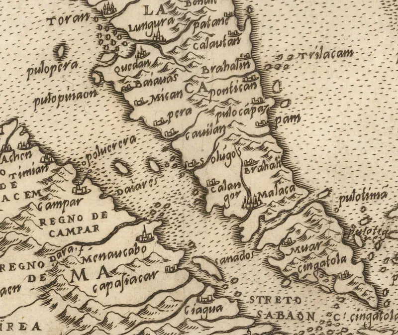
Four and a half centuries ago, a Venetian mapmaker sat down to draw the edge of the known world, and somewhere in that tangle of coastline he labelled a small island off the coast of Kedah: Pulo Pinaon. It is the Portuguese rendering of Pulau Pinang – and it means the island was already on the map, already known to the sailors and traders whose reports found their way to Europe.
The map is Il Disegno Della Terza Parte Dell’Asia – ‘The Map of the Third Part of Asia’ – published in 1561. The man behind this magnificent masterpiece was Giacomo Gastaldi (1500–1566), widely regarded as the foremost Italian cartographer of the sixteenth century. Born in Piedmont, he settled in Venice by 1539 and came to mapmaking only in his forties, after a career as an engineer. There he made his name as an engraver and cosmographer, rising to become cosmographer to the Republic of Venice.
Run your eye down the Straits of Malacca and the names start to feel familiar, if you squint a little: Quedah (Kedah), Pera (Perak), Pulo Pinaon (Pulau Pinang), Calangor (Selangor), Malaca (Melaka), Muar, and Singatola (Singapura).
One of the map’s more intriguing features is a table setting each place name of the day beside its counterpart from antiquity. There, the promontory at the tip of Asia – Ptolemy’s mysterious Malæi Colon – is matched to Capo Cingapola, the Cape of Singapura.
Sources:
Thomas Suarez (2012), ‘Early Mapping of Southeast Asia’
T. Osborne (1748), ‘An Universal History, from the Earliest Account of Time’, Volume XX
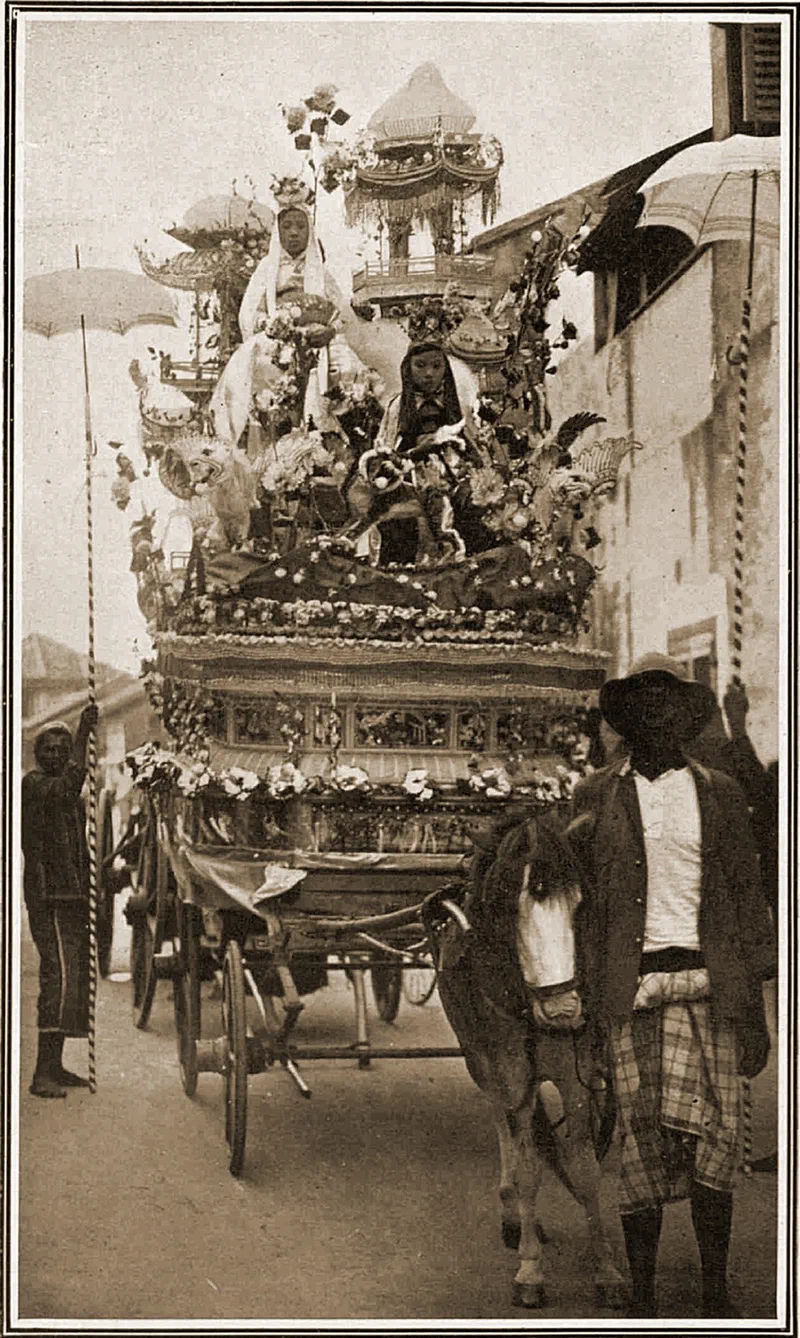
The 14 June 1924 edition of The Sphere – an illustrated British newspaper which ran from 1900 until 1964 – featured, in its “Surveys of the World”, photos of “A Chinese Festival in the Straits Settlements”. One of the photos, shown here, was captioned – ‘Honouring the god of prosperity in Penang – one of the gorgeous cars in the “Chingay Festival Procession”’
Time-lapse video of the journey from Lower Station of the Penang Hill Railway to Hickory.
Getting there takes a bit of timing: catch the train that departs on the half-hour (the only one that stops at the intermediate station) and tell the driver you’d like to alight at the Lower Tunnel Station.
The bungalow, originally named Dolce Donum*, was reported almost complete by 16 August 1929. First owned by Chee Wor Look, it was sold soon after to Tye Poh Soon – a founding member of the Penang Flying Club. During the war, occupying Japanese forces commandeered his residence and renamed it Hickory. According to his granddaughter, they simply found the Latin name too hard to pronounce.
Moe (Mohammad Nasrullah Bin Zulkifli) and I are happy to announce that the People of Penang Podcast is back! Well, we never really went away. We kept on recording but could not find time in our busy schedules to release them. Check out the exciting mini-series which just dropped and the upcoming episodes and developments.
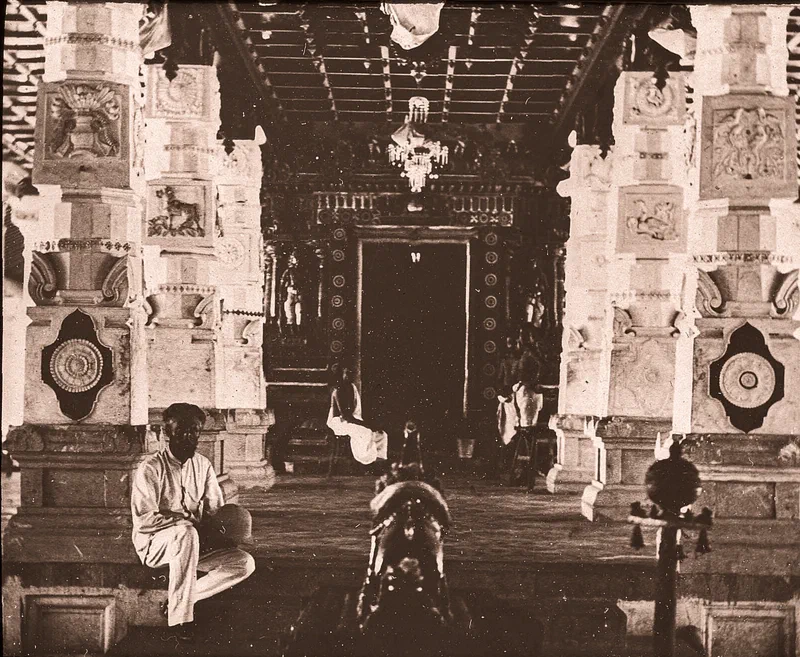
There is a photo in the Bibliothèque nationale de France (French National Library) captioned “Intérieur d’un temple indous à Penang” (Interior of an Indian temple at Penang), attributed to a P. Fauque.
It shows the interior of Nattukkottai Chettiar Temple – established around 1854 – as it was in 1884, or more precisely sometime in May 1884, as the French explorer Paul Fauque who took the photo wrote:
“In the month of March, 1884, I embarked at Marseilles for Singapore, accompanied by Mr. Burlaud … On the 29th of April we beheld Singapore once more, and in the month following, having touched at Malacca, at Selangor, and at Perak – which possess tin mines of no small importance – and thereafter at Penang …”
Source:
Paul Fauque, “Revue française de l’étranger et des colonies et l’exploration”, Volume 3, 1886
Photo, Bibliothèque nationale de France. Identifier: ark:/12148/btv1b53000021g
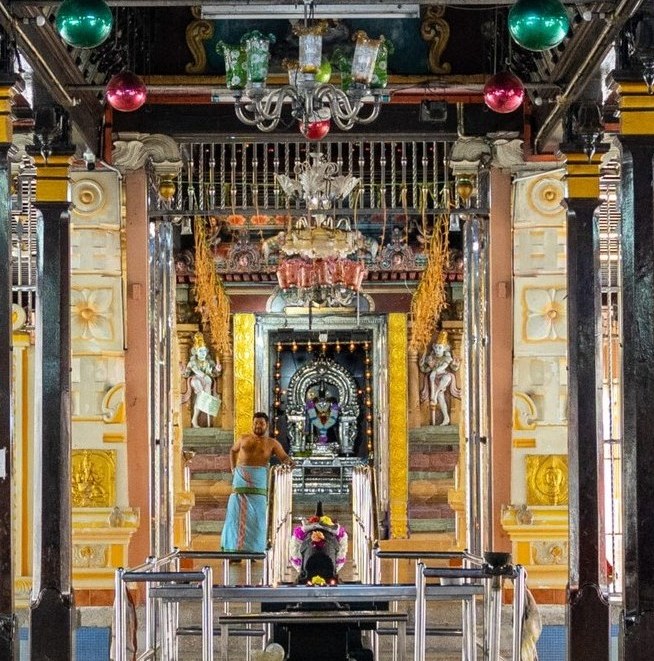
Present day photo, credit Penang Harmony Corporation-HARMONICO
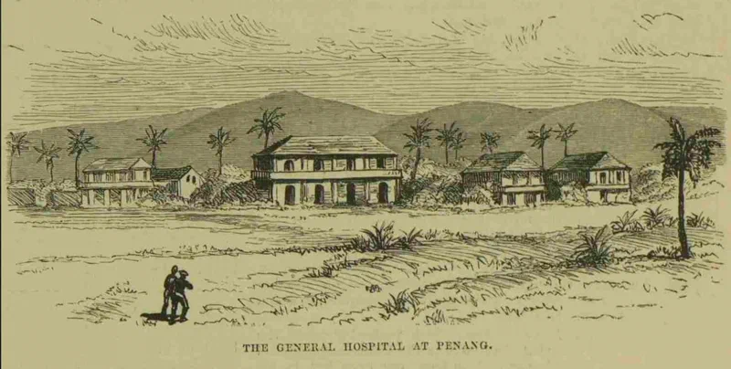
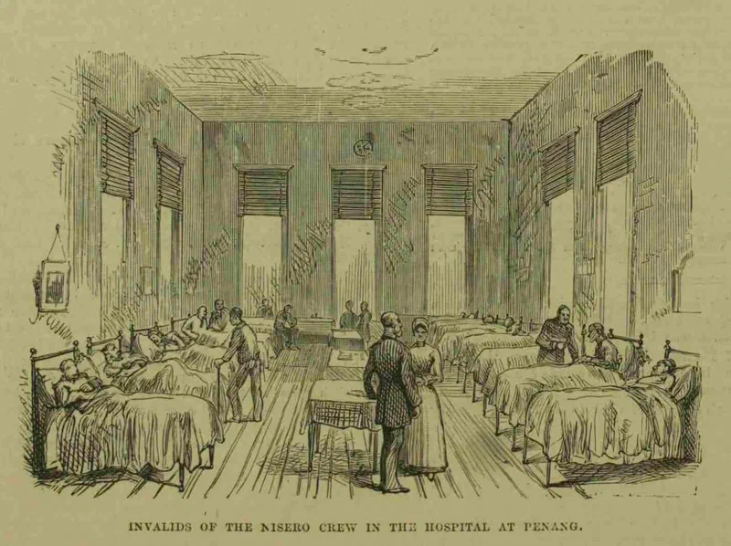
View of the exterior and interior of the General Hospital in Penang in late 1884, as reported by a London newspaper covering the then sensational story of the capture and release of the crew of the ship Nisero (Nicero) from Sumatra — facilitated by the Penang merchant Khoo Thean Poh, the brother of Khoo Thean Teik (See earlier June 17 post: https://www.facebook.com/share/p/1LkKPU3hYK/
).
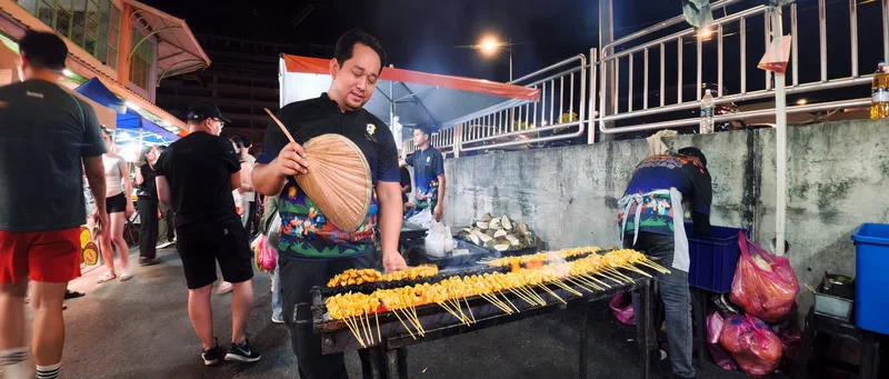
Capturing the vibe of the pasar malam at Tanjung Bungah with a wide-angle cinematic lens. This long-running night market has been going strong at its current spot, around the Tanjung Bungah market building, for years.
The market building seems to have been completed or opened around mid-1996, so the pasar malam must have moved here sometime after that. Before the move, it was also held on Tuesday nights – along Jalan Heah Joo Seang, Jalan Chee Swee Ee, and Jalan Concord 8 – dating back to at least the early ’90s.
If anyone knows exactly when this pasar malam relocated, or when it first started at Concord Garden, please let me know.