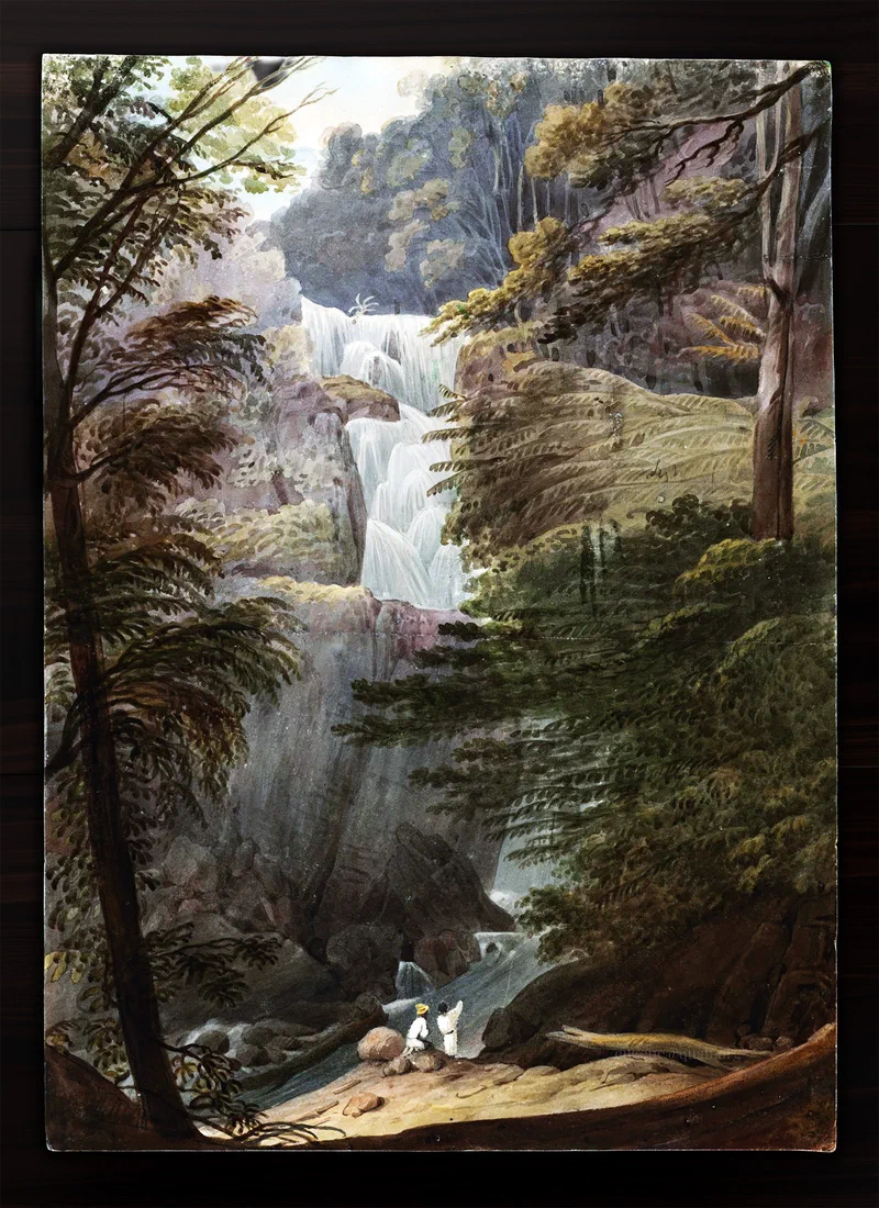
In 1828, an English painter arrived in Penang not on a naval commission or a wealthy patron’s shilling – but entirely on his own terms, sketchbook in hand.
Augustus Earle was a different kind of artist. Where earlier painters working beyond Europe depended on wealthy patrons or were East India Company employees working abroad, Earle had found a more precarious but liberating arrangement: he financed his wanderlust through his art, moving through the world on instinct and opportunity.
This work, ‘Water fall, Penang’, was painted during the Australia-to-India leg of his travels. In October 1828 he boarded the Rainbow in Sydney, tracing a route that reads like a Victorian adventure novel – the Caroline Islands, Guam, Manila, and Singapore – before putting ashore at Penang. He would eventually disembark at Madras.
The painting is now held within the Rex Nan Kivell Collection of the National Library of Australia.
Source: Bernard Smith (1966), ‘Australian Dictionary of Biography’, Volume 1, Melbourne University Press.
Disclosure: Image white balance and tonal curve adjusted.
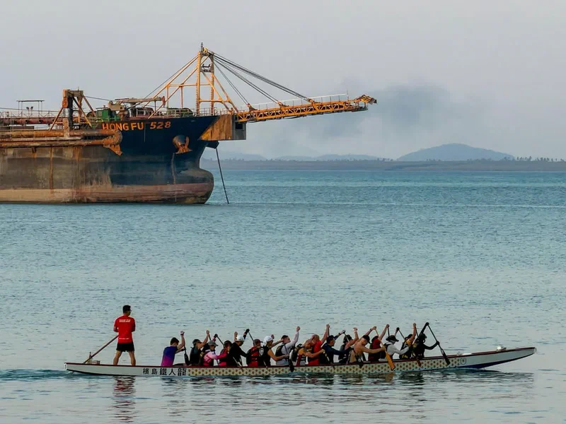
A dragon boat, crewed by members of the Penang Titans Dragon Boat Club (檳島鐵人龍), glides past the massive Hong Fu 528 off Straits Green, Tanjung Tokong – a striking contrast between tradition and modern engineering.
This vessel is a hopper dredger, essentially a giant vacuum of the sea. It sucks up sand, gravel, and silt from the seabed, storing it in its onboard “hopper,” which is how it gets its name.
The materials it collects are being used in the construction of the nearby artificial Andaman Island.
You may have heard of mobile libraries and food trucks – but nearly a century ago, Bukit Mertajam, a town on the mainland of Penang, had something even more unusual: a mobile church, driven around by a French padre.
This photograph shows the vehicle, which was dubbed an ‘auto-church’. In the picture, Father Riboud is seen conducting an illustrated Bible lesson for children in Bukit Mertajam.
A newspaper report at the time noted:
“Father Riboud, a French Catholic missionary, believes In bringing the Gospel of God right to the door … So he secured an automobile and equipped it with everything a chapel needs. Now he can minister to the soul-needs of the natives ….”
Father Louis Riboud was born on January 19, 1888, in Montigny-sur-Loing (Seine-et-Marne), France. He was mobilised for military service from 1914 to 1919 during the First World War. After the war, he was ordained a priest on March 12, 1921, and departed for Malaya on September 26 that same year.
He first served in Bagan Serai before being assigned to Bukit Mertajam, where he worked from 1926 to 1935. In 1936, Father Riboud was placed in charge of the Indian parish in Penang, where he spent the rest of his missionary life until his death on September 23, 1960.
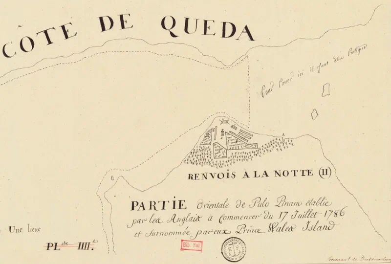
A French reconnaissance mission may have given us the oldest surviving plan of Penang’s capital.
In October 1786, Captain Antoine Bruni d’Entrecasteaux set sail from Pondicherry, India, on the frigate Résolution, accompanied by the corvette Subtile. The Résolution was formerly HMS Romulus, a 44-gun ship of the British Royal Navy captured by the French at Chesapeake Bay during the American Revolutionary War.
Officially, the mission was to survey Southeast Asian ports, but it had a secret purpose. As French historian Henri Cordier revealed in 1903: “The real purpose of d’Entrecasteaux’s mission… was to inform [the French in] China of the future designs of the English against that great empire.”
His orders were to reconnoitre strategic locations including Mergui, Malacca, and Manila, assessing whether Spain might provide “Succour” against England in the event of war.
The expedition, making slow progress as they had to sail against the monsoon winds due to a late departure, would have reached Pulau Pinang – marked as “Pulo Pinam” on this map – in late 1786, just months after Captain Francis Light established his settlement at Tanjung Penaga. From the route taken by the Résolution, this chart would have been made during this outward leg of the journey in 1786 to Canton as it shows a northern approach to Penang.
This map, recently made available by the Bibliothèque nationale de France, is now the earliest known plan of George Town† – predating the often-reproduced 1792 Popham plan by several years.
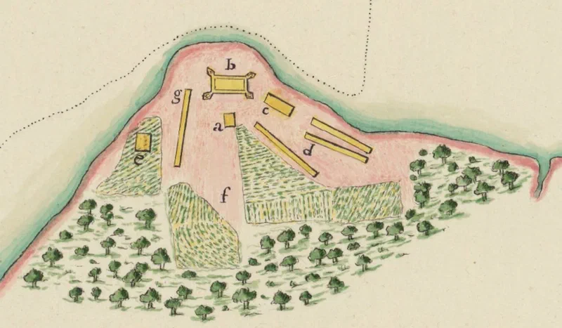
Unfortunately, the accompanying “Renvois à la note” (key/legend) has not been found. Place identifications are based on Capt. Light’s journal, his 1787 letter to Andrew Ross, and Fr. Garnault’s correspondence with Fr. Letondal.
Places marked on the map: (a) The Church of the Assumption – then just an unnamed wooden building. According to a letter by Fr. Garnault dated 4th June 1787, he set “sail on the 22nd [February 1787] upon an English Vessel which, at the Request of the Governor [Capt. Light] of my new Residence, Pulo-Pinang, carried me to Pondicherry”. He returned on Assumption Day later that year (15th August). (b) Fort Cornwallis – merely a stockade of nibong palm wood (c) Buildings along future Beach Street (wooden structures, per Light’s records) (d) Building along future King Street (e) Capt. Light’s house – present-day Convent Light Street (f) Paddy fields along future Penang Road (also shown in Popham’s later map) (g) The sepoy lines (barracks) (h) Sungai Pinang
Sources:
Henri Cordier (1911), “La mission de M. le chevalier d’Entrecasteaux à Canton en 1787”
Susan E. Schopp (2020), Sino-French Trade in Canton (1698–1842), p. 122
BNF: “Partie orientale de Pulo Pinam etablie par les Anglais…” (ark:/12148/btv1b53297429b)
† A note on the name: Contrary to popular belief, East India Company records show that “George Town” was only officially adopted in 1794.
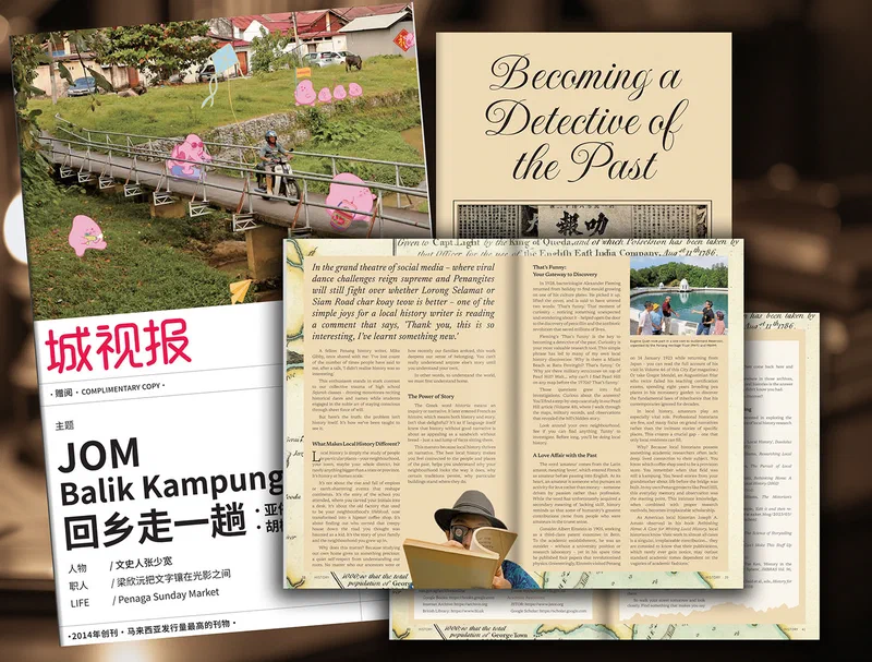
Many of you wanted to attend the sold-out George Town Festival Plus (GTLF+) workshop, “Becoming a Detective of the Past” — a session on the practice and craft of local history research.
Quite a few of you also asked if I could write about it for those who couldn’t make it. So, as promised, here it is.