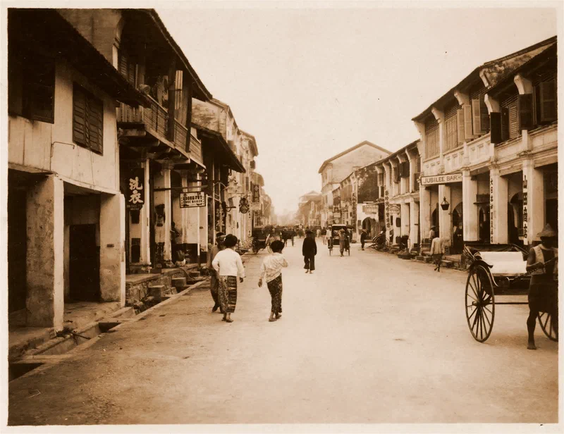
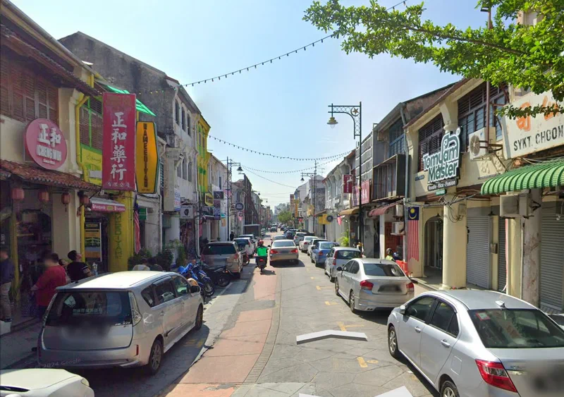
Early 20th century street view from the photo album, “Views of Penang, Prai, Rimau Island (Malaya) …”, belonging to Australian businessman, Sir William Dixson, kept at the State Library of New South Wales.
This particular shot shows Campbell Street, identifiable by the presence of the Jubilee Bar at No. 169/171 belonging to Kam Cheng Sun. This dates the photo to possibly 1906, as the following year the bar moved to No. 165.
Sources:
Pinang Gazette and Straits Chronicle, 5 December 1906, p.4
Pinang Gazette and Straits Chronicle, 7 December 1907, p.8
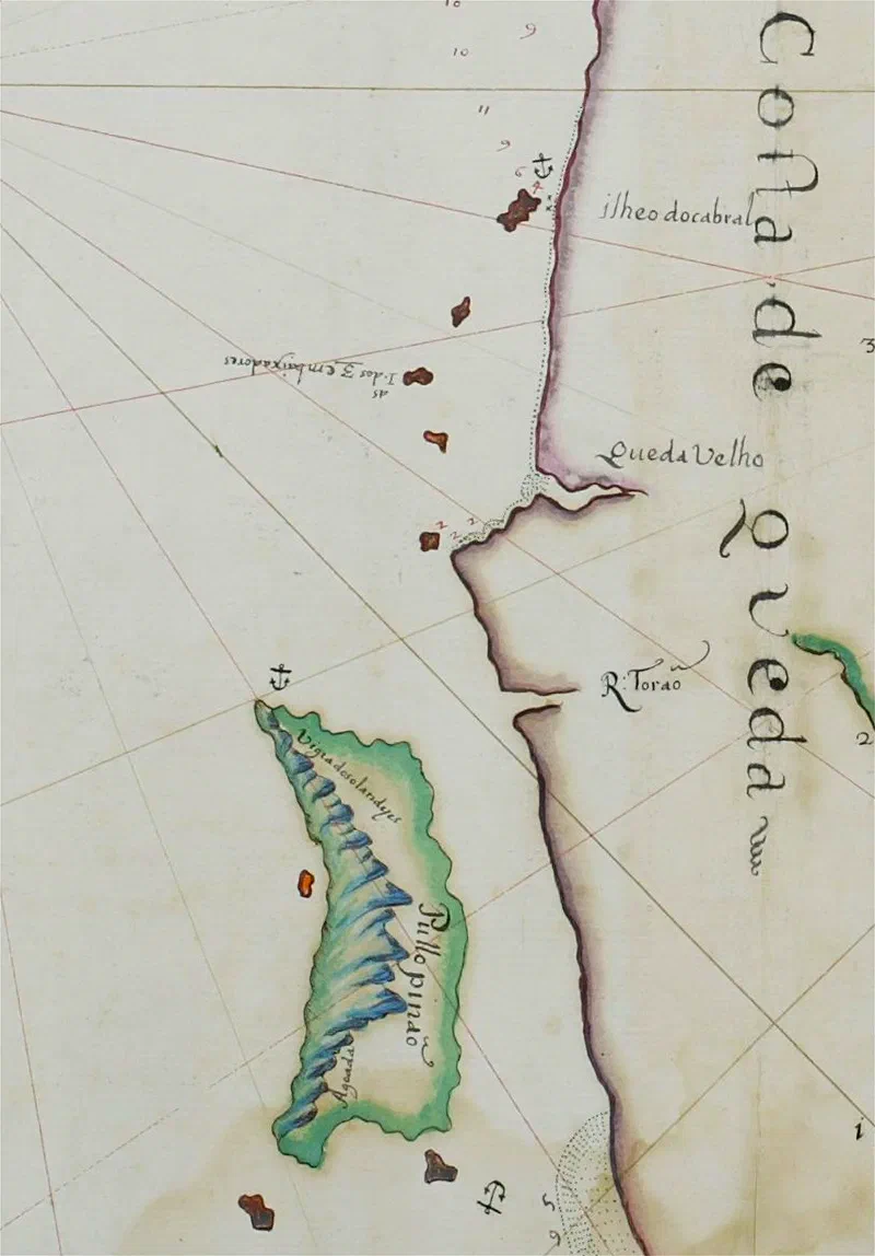
Published in 1654, this rare Portuguese chart of the northern part of the Straits of Malacca was produced by André Pereira dos Reis. It is now kept at the Dutch Maritiem Museum in Rotterdam.
Penang island is shown as Pullopinaõ - Pulau Pinang. The island is drawn in colour with an illustration of the central Penang hill range. At Muka Head, there is an interesting note - Vigia dos olandyes (Lookout of the Hollanders); this suggests a Dutch presence there.
Three of Penang’s minor islands are shown but not named. The position of Pulau Kendi at SW and Pulau Rimau at SE of the main island is correct, although Pulau Betong on the West coast is shown too far north. Two anchorages are indicated, at Muka Head and South of Pulau Rimau.
At Teluk Kumbar it is indicated there is Aguada, indicating that the Portuguese stopped to obtain fresh water from there. The first Portuguese that stopped at Penang whose name we know of was Pedro do Carvallo who stopped by in August 1596 at roughly the watering spot indicated by this map made 58 years later.
Another interesting place-name indicated is Queda Velho (Old Kedah), situated at the Merbok River estuary. The three smaller islands of the Bunting group of islands are collectively named Ilheo dos 3 embaixadores (The 3 Ambassador Islets) - Pulau Panggil, Pulau Songsong, Pulau Bidan. The main Bunting island is puzzlingly called Ilheodocabral - Islet of Cabral. Pedro Álvares Cabral was the first European to reach Brazil in 1500. He also made it to India but never came to the Straits of Malacca. The coast of the Malay Peninsula is marked as Costa de Queda (Coast of Kedah).
There is also the mysterious river called Toraô. In maps from this time, Toram (variously spelled Torano or Toraô) was apparently a minor port, sometimes indicated to be south of Penang between Beruas. In this map, it seems to be more likely the Muda or Prai River.
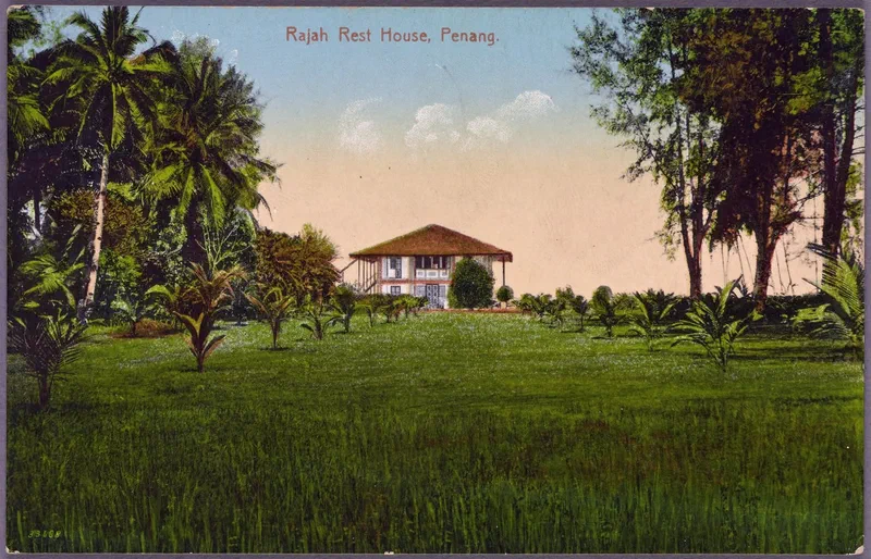
This vintage postcard offers a glimpse into Northam Road in the early 20th century. The wooden bungalow seen here once stood on Northam Road. In 1935, the current brick Kedah House was built over it.
This extensive seafront property was (and still is) the residence of the Sultan of Kedah in Penang. The photo was likely taken by Penang-based photographer Ernst August Kaulfuss, who was also royal photographer to the Sultan of Kedah. S.M. Manicum published many of Kaulfuss’ scenes of Malaya as hand-coloured postcards, including this one.
An interesting note - many of S.M. Manicum’s postcards carried the phrase “Patronized by H.M. The King Emperor of India.” While this may sound grand, it simply meant that British royals had purchased some of his postcards—an early marketing strategy at its finest. Since it references the Emperor, we can deduce that the postcard was published after 1901 (the year Queen Victoria, Empress of India, passed away).
With Kaulfuss having passed in 1908, the image itself would have been taken before then, while the postcard was likely published around 1910—the 16th in a fascinating series of Malayan views.
Source:
Postcard, New York Public Library (Public Domain)
Cheah Jin Seng (2013), “Penang: 500 early Postcards”, pg. 168