January 2025

Browse the archive
202655
202558
202455
202338
202224

A Dutchman's Account of Penang in 1613

On Sunday, 28 November 1613, the East Indiaman “Globe”, belonging to the English East India Company (EIC), weighing 527 tons burthen, on the homeward leg of its journey, stopped by the island of Pulo Pinaon [Pulau Pinang] at the north entrance of the Straits of Malacca. This was the 7th voyage to the East Indies by the 10-year-old English trading company. A week earlier, Shakespeare’s play “Macbeth” had just been premiered back in England, at the Globe theatre. Malacca was then still in the hands of the Portuguese - which the Dutch had attempted a few times to take by force. The English were but minnows as a trading nation.

One of the founders of the EIC, Sir James Lancaster, had visited Penang 19 years earlier in 1592. He sojourned on Pulau Rimau - off the south coast of the main island - for three months for his crew to recover from scurvy.

The “Globe”, commanded by Captain Anthony Hippon, had started its journey in 1611. Curiously, on board on this trip was Peter Floris, a Hollander in his 30s who was a former employee of the Dutch East India Company, the VOC. Pieter Williemz van Elbing, a smooth-talking merchant with extensive knowledge of the East Indies trade, used the name Peter William Floris while working for the English - presumably to conceal his identity. After leaving the VOC he had joined the EIC. Naturally, the Dutch were not pleased that one of their own was working for the English company when they found out. This particular journey was in fact Floris’ idea, which he proposed to the EIC and even obtained the support of King James I. Prior to reaching Penang, the “Globe” had just opened a factory - trading outpost - at Ayutthaya and Pattani, a first for the EIC.

Floris noted in his journal, “Wee came to an ancker under Pulo Pinao [Pulau Pinang] att the W. syde [West side] att 10 faddem [fathom], being a greate iland, and founde the description of John Hugens to bee very true as well of the Straighte of Malacca as of this iland; for by his direction wee founde freshe water, being a little ile [Pulau Rimau] att the S. syde of the greate sand baye, and right over agaynste the little iland [Pulau Kendi] southward is a small baye [Teluk Kumbar] besette on both sydes with rockes, and is full of oysters, and by this baye is verye fayre [fair] water and easye to bee fetched. Wee sente our boate and skiffe ashoare to fetche water. Wee were come to an ancker to farre from the shoare, aboute 1 1/2 leagues, for wee mighte have come att 6 and 7 faddem, a good muddy grounde, within 1/2 league of the shoare”.

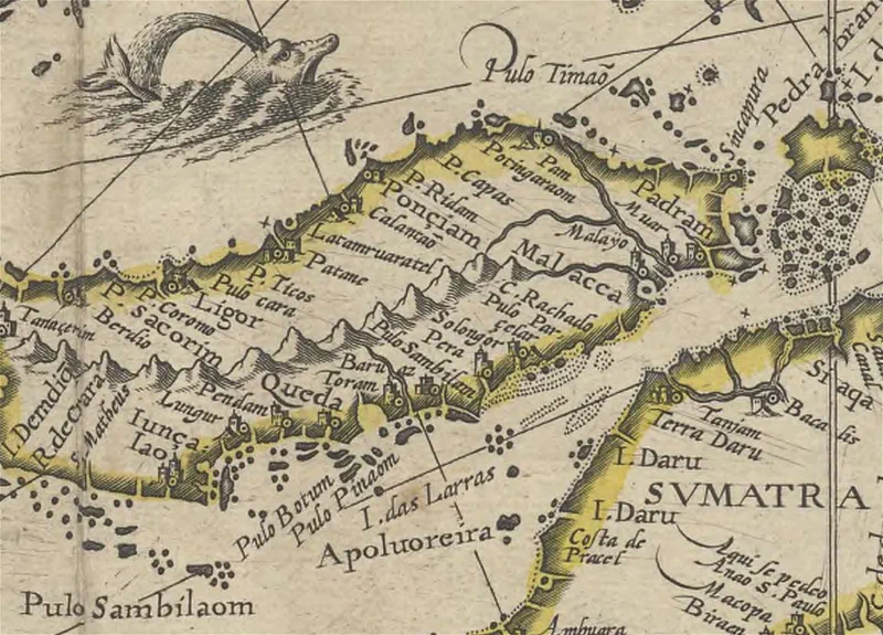
The John Hugens mentioned by Floris was his fellow countryman - Jan Huyghen van Linschoten - a spy, merchant, writer and traveller who divulged the navigational secrets of the Portuguese in his groundbreaking work “Itinerario” that greatly increased the knowledge of the Dutch and later the English regarding the East Indies.

The following day, Floris indulged in what tourists to this day still do: gorging on good Penang food: “I wente myselfe ashoare, and the oysters being so fayre and good I ate as many as made mee sicke”. Floris also discovered there had been another visitor after Lancaster’s 1592 visit: “Heere wee founde a Portingalls [Portugal’s] name, P° [Pedro] do Carvallo, a° [anno] 1596 Auguste, cutte in a tree”. Not wanting to be left out, he too left his mark - “whereuppon wee also cutte Globe van London, 1613, 29 November, for a signe”.

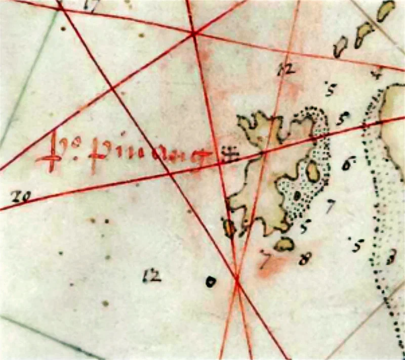
Interestingly, there is a place in Teluk Kumbar called Pasir Belanda; suggesting that the place had been a watering stop for the Dutch. Below is the map of the “Straights of Malacca” from “Itinerario” and a 1647 Dutch map showing the outline of Pulau Pinang in detail.
A Dutchman’s Account of Penang in 1613 — image 1
A Dutchman’s Account of Penang in 1613 — image 2

Source:

  1. Peter Floris (1613), “Peter Floris: His Voyage to the East Indies in the Globe 1611-1615, the contemporary translation of his journal”, edited by W.H.
    Moreland, London, printed for the Hakluyt Society, 1934
  2. Bij Johan Blaeu (1647), “Kaart van Straat Malakka met de westkust van het schiereiland Malakka, de west- en oostkust van Sumatra”’, Map.
  3. India Office - Marine Department Records, IOMAR/L/MAR/A/XIII

https://www.eugenequah.com/blog/a-dutchmans-account-of-penang-in-1613/

Copyright © 2026 Eugene Quah Ter-Neng. All rights reserved.

Additional Notes on the Name Gunung Jerai

The ancient Malay literary work, Hikayat Merong Mahawangsa (حکاية مروڠ مهاوڠسا), or the Kedah Annals, chronicles the semi-mythical founding and royal genealogy of Kedah. It mentions that the mountain was once called Pulau Serai. Poetic language aside, there is evidence that Gunung Jerai might indeed have been an island in the distant past. Geological studies indicate that between 100–300 C.E., rising sea levels submerged much of the area around its foothills, leaving it surrounded by a shallow sea.

Later, “perhaps 100 years from about 1300 to 1400 [C.E.],” as revealed in research by Khoo Teng Tiong, a notable Universiti Malaya geologist, there was a “dramatic fall in sea level of perhaps 2–3 m within a span of 100 years.” Khoo referred to this significant sea-level drop in the Straits of Malacca as the Merong Event, which likely transformed Pulau Serai into Gunung Jerai.

In 1826, Captain Henry Burney, who was sent to Siam to negotiate the treaty that would later bear his name, wrote that “the Siamese name of Kedah, Mooung Serai (Mueang Sai), is taken from Kedah Peak, which they call ‘Khas Serai’” - เขาไทรบุรี (IPA: kʰǎw sāj) - “, and the Malays ‘Gunong Jerai’ or ‘Cherai’.” Burney further noted that the King of Kedah was granted the title Phraya Meung Sai (IPA: pʰrá.jāː mɯ̄aŋ sāj), meaning Governor of the Province of Sai.

Col. Gerolamo Emilio Gerini, an Italian soldier and scholar serving in the Siamese Army, supported Burney’s explanation. Writing in 1905, Gerini stated that Jerai was a corruption of the Siamese word srai (also romanised as chrai or sai), meaning banyan tree. During the period when Kedah was under the control of Siam, the occupied territory was officially called Srai-puri (Saiburi in romanised Malay). The word puri or buri (from Sanskrit บุรี) means “city,” making Saiburi - ไทรบุรี (IPA: saj bū.rīː) - translate as “City of the Banyan.”

There are several species of banyan trees, but the type associated with Gunung Jerai is most likely Ficus benjamina, commonly known as the weeping fig or ficus tree. Interestingly, it is also the official tree of Bangkok. In Malay, it is called pokok jejawi (ججاوي) and is native to Peninsular Malaysia. Incidentally, Sungai Jawi near Nibong Tebal, which was once part of Kedah, was referred to as Sungai Jejawi in older maps.


Sources: See the article. Find out more about Jerai Geopark – the nation’s latest – in this article:

https://www.penangmonthly.com/gunung-jerai-the-prominent-peak-on-the-north/

https://www.eugenequah.com/blog/additional-notes-on-the-name-gunung-jerai/

Copyright © 2026 Eugene Quah Ter-Neng. All rights reserved.

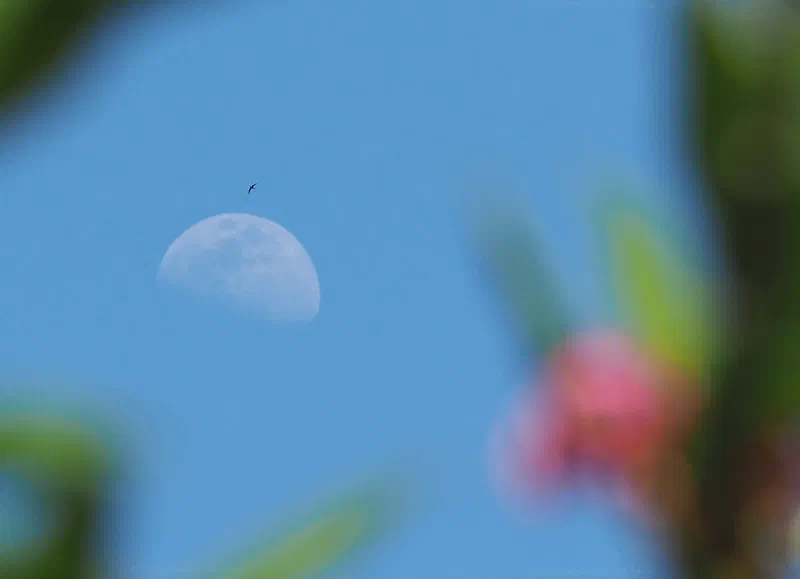
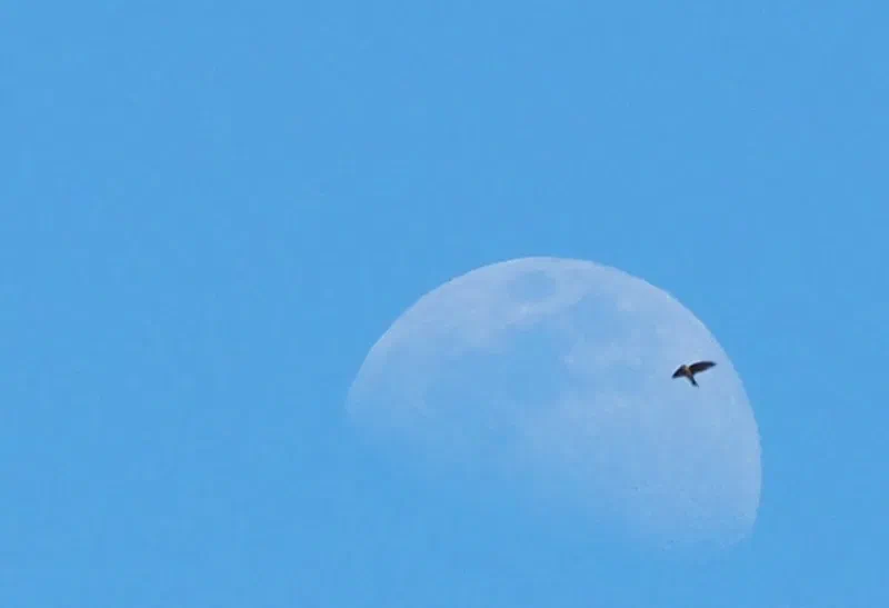
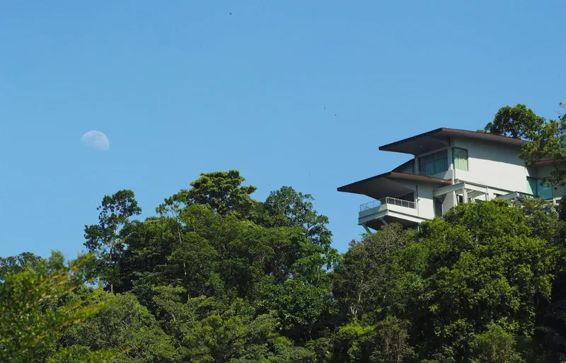
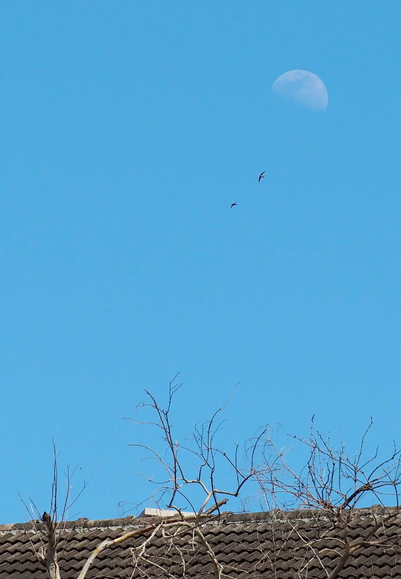
The waxing gibbous Moon by day

On 8 January 2025, the waxing gibbous moon was visible in daytime. Moonrise was at 2:06 p.m. These shots were taken when the moon was at an altitude of 21° above the horizon, heading 75° ENE.

The waxing gibbous Moon by day — image 1
The waxing gibbous Moon by day — image 2
The waxing gibbous Moon by day — image 3
The waxing gibbous Moon by day — image 4

https://www.eugenequah.com/blog/the-waxing-gibbous-moon-by-day/

Copyright © 2026 Eugene Quah Ter-Neng. All rights reserved.

The Glugor Seaplane Airport

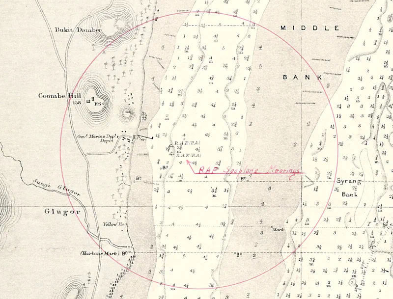
In 1928, Royal Air Force seaplanes, also known as flying boats, began to use the southern part of the Strait of Penang as a mooring area - a landing strip on water. The Pinang Gazette reported that “four R.A.F. flying boats, on a 28,000 miles cruise [from England] to Australia are expected to arrive in Penang on Thursday [16 February 1928] from Victoria Point. They will moor at the New Marine Department Depot at Glugor where they will be re-fuelled”. The historic flight “when completed … [would] have carried out a service exercise never yet attempted by any other nation”.

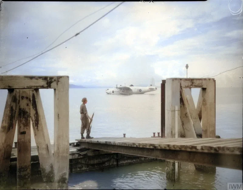
A contemporary report said the makeshift establishment with a small pier at “Glugor has frequently been used as a landing base for flying boats, but little has been done previously to equip it with proper materials for a permanent landing base”. In November 1937, the legislative council of the Straits Settlements approved $64,000 to upgrade it to a “flying-boat base for Penang”. The following year, the press reported that the “covered-way to the sea plane and flying boat anchorage” of the “Glugor Airport” will be illuminated. The Japanese Imperial Navy would later continue to use the landing base during the occupation of Penang. The following photo from the Imperial War Museum shows the pier of the seaplane base just after the war in 1946:

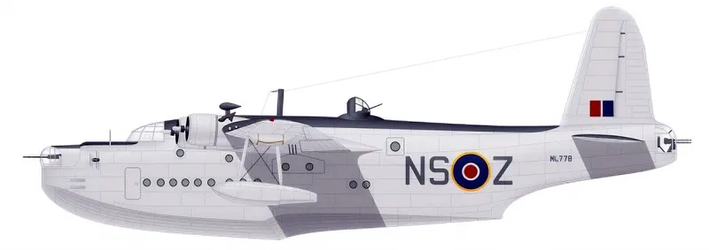
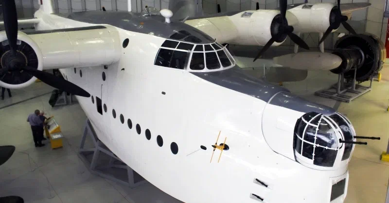
“A sentry of the Royal Air Force Regiment stands guard on the jetty of the flying-boat staging post at Glugor, Penang, Malaya. Anchored in the bay beyond is a Short Sunderland Mark V, NJ276 ‘M’, of No. 230 Squadron RAF”

The Glugor Seaplane Airport — image 1
The Glugor Seaplane Airport — image 2
The Glugor Seaplane Airport — image 3
The Glugor Seaplane Airport — image 4

Sources:

  1. Pinang Gazette and Straits Chronicle (1937), " $64,000 Flying-Boat Base For Penang", 18 November 1937, Page
  2. Pinang Gazette and Straits Chronicle (1928), “First Log Of R. A. F. Flying Boats” 13 February 1928, Page 9
  3. Pinang Gazette and Straits Chronicle (1938), “Glugor Air Port To Be Illuminated”, 25 October 1938, Page 3
  4. Imperial War Museum (c. 1946), “The Royal Air Force in the Far East, 1945-1946” Photo: CF 741

https://www.eugenequah.com/blog/the-glugor-seaplane-airport/

Copyright © 2026 Eugene Quah Ter-Neng. All rights reserved.

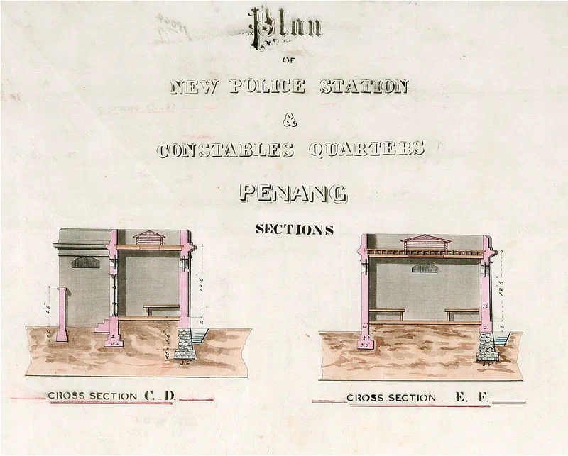
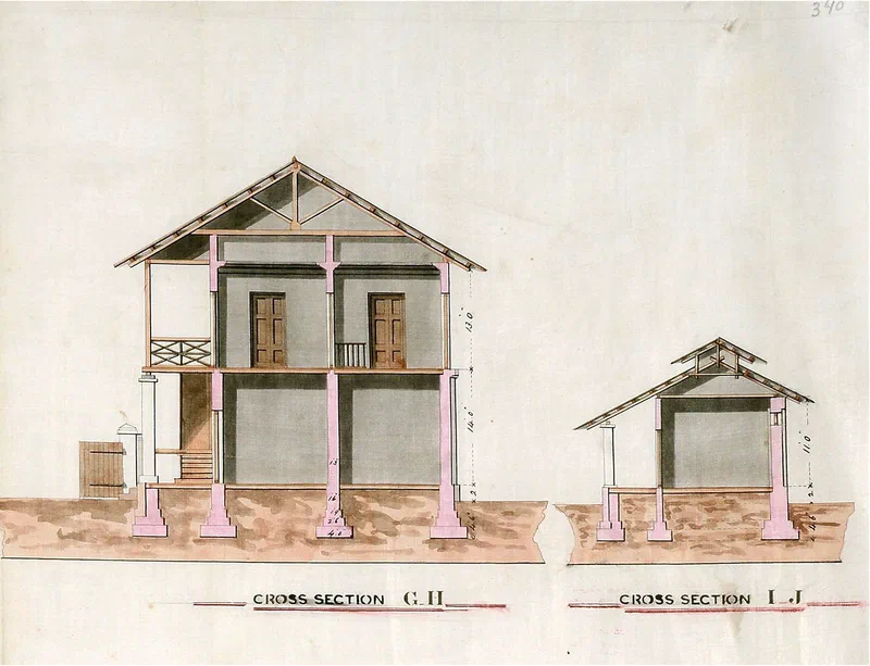
Plan of New Police Station & Constable Quarters, Penang (1879)

On Friday, 16th May that year at 1 p.m. the President of the Municipal Commissioners, Lieutenant Governor C.J. Irving convened a special meeting to table the “Report of the Inspector-General of Police”. It was attended by Foo Tye Sin, V.M. Noordin and José Maria Rodrigues Magalhaens, the Acting Deputy Colonial Engineer. One part of the report touched on the state of police stations in Penang:

“Many of the Stations and Married Constables’ Quarters are not in good condition for want of ordinary repairs. This is specially the case with the buildings in Province Wellesley. The Acting Superintendent reports that ‘Requisitions for the necessary repairs have been made on the Public Works Department: but have in most cases met with no attention and I have been informed that they could not be executed for wants of funds’.

Permatang Pasir Station in Province Wellesley has, by the rectification of the boundary; ceased to be a frontier station, and should be removed to Kúbang Sêmeng. A new Station, with Inspector’s Quarters, is much needed at Bukit Têngah, Province Wellesley”.


The plan is likely for the proposed station at Bukit Tengah. However, at the time of the meeting, land had also just been acquired for a new station at “the junction of Hutton Lane and Pangkor Road”, clouding matters.

The beautifully coloured architectural plan was prepared by J.M.R. Magalhaens. It was kept at the National Archives of Singapore. The cross sections are marked C.D. - Single [Jail] Cells, E. F. - General Cells and G.H. Inspectors Quarters, I.J. - Out Offices

Plan of New Police Station & Constable Quarters, Penang (1879) — image 1
Plan of New Police Station & Constable Quarters, Penang (1879) — image 2

https://www.eugenequah.com/blog/plan-of-new-police-station-constable-quarters-penang-1879/

Copyright © 2026 Eugene Quah Ter-Neng. All rights reserved.

The Chinese cemetery at Batu Lanchang and the origin of its name

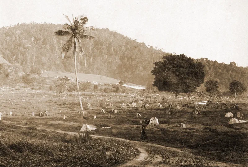
View of the Chinese cemetery at Batu Lanchang at the turn of the 20th century (before 1908) by the German photographer Ernst August Kaulfuss. In 1899, it was reported the burial ground was already “over-crowded with tombs” and declared by “many Chinese geomancers to the best Fengshui in Penang”. According to a contemporary account, at “the head of the private road to the burial-ground [was] a sign-post to ‘Koh Chye hill’, adjoining Batu Lanchang burial-ground” - the private cemetery of the Koh family, where the patriarch Koh Lay Huan or Che Wan was buried in 1826. Che Wan arrived just days after Captain Light landed at Tanjong Penaga (now George Town) and requested from him permission to settle in Penang.


Origins of the name Batu Lanchang

The 1846 edition of the “Simmonds Colonial Magazine and Foreign Miscellany, Volume 8”, explains that “Batoo Lanchang [Batu Lancang], derives its name from a large rock on the sea-beach, near to the village of the same name … which is held in much reverence by the Malays as a Tampat Crammat [Tempat Keramat], or Holy Spot”.

“When attacked by severe sickness or by other worldly calamities, [they] would make solemn and religious promises” at the keramat seeking assistance. If the outcome is favourable, the person making the vow would prepare a kenduri to thank the spirit.

At this thanksgiving ceremony, offerings are made, placed on a symbolic boat called a lanchang, “sometimes, made of wood, but more frequently, of leaves and plantain stalks … rigged with a leaf for a sail and then sent off to sea”; symbolising the payment of a vow fulfilled - “Sudah bayar nyat [sudah bayar niat]”. The offerings are often the flesh of both white fowl and black fowl, cooked and half-cooked pulut (glutinous rice) and bertih (rice pops).

The actual boat called lanchang or lancharan is a “Malay war-vessel; a ship built for speed and fighting”. The English and Portuguese nautical terms, launch and lanchão respectively, meaning “the largest boat carried on an armed sailing ship”, are derived from lanchang.


The Chinese cemetery at Batu Lanchang and the origin of its name — image 1

Source:

  1. Peter Lund Simmonds, ‎William Henry Giles Kingston (1846), “Simmonds Colonial Magazine and Foreign Miscellany” Vol.8 pg 57-58.
  2. Walter William Skeat (1900), “Malay Magic: Being An Introduction To The Folklore And Popular Religion Of The Malay Peninsula”, pg. 433-435
  3. MBRAS (1885), “Notes and Queries - Issues 1-4”, pg. 65
  4. Yeow Sew Beow (1899), “Street Nomenclature”, Pinang Gazette and Straits Chronicle, 22 April 1899, pg. 4
  5. Photographs with town views, landscapes and people of Penang, Perak, Siam, Singapore and Atjeh Or. 27.424 (Photo)

https://www.eugenequah.com/blog/the-chinese-cemetery-at-batu-lanchang-and-the-origin-of-its-name/

Copyright © 2026 Eugene Quah Ter-Neng. All rights reserved.

The landing place at Malacca, 1830

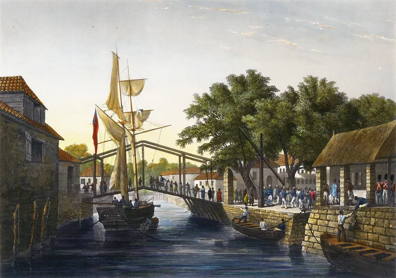
This is a gorgeous 1835 hand coloured chine collé aquatint of the landing-Place at Malacca (Débarcadère, à Malacca) by the Swiss painter and engraver Sigismond Himely which was based on an engraving made by a crew member of the French corvette “La Favorite” between 12-13 August 1830.

Captain Cyrille Pierre Théodore Laplace (1793–1875) would circumnavigate the globe on board “La Favorite”. The following, translated from French, are extracts from the account by Laplace of the part of the voyage from Penang to Malacca:


10 August 1830 - On the afternoon of August 10th, we espied the English flag waving above the fortifications of the beautiful Isle of Prince of Wales … [the] sun was nigh unto setting, when a fresher breeze caused us to swiftly pass beyond Pulo-Pinang. The weather was most magnificent: upon the sea, which was scarce disturbed, a great number of vessels, their sails gently rounded by a light wind, were entering or departing from the harbour … on the evening of the 10th, I gained sight of the two small Aroas isles, whence pirates oft lie in wait for vessels too weak to offer resistance; these islands, together with Mount Parcelar [Bukit Jugra], situated upon the Malay coast, serve as points of recognition for traversing the banks.

11 August 1830 - After a night spent at anchor, marked at its commencement by a violent tempest, the corvette, propelled by a fair breeze, surmounted the dangers and, keeping close to the Malay shores, made way for Malacca.

12 August 1830 - We passed the following night in these waters; it proved one of the most disquieting of the entire voyage: the weather was dark and threatening; squalls, coming from opposing quarters, rendered yet more perilous by blinding lightning and nearly ceaseless rain, succeeded one another until morning … at sunrise, Malacca came into view in the distance.
…
[After the] inevitable ceremony of twenty-one-gun salute having been concluded, I descended ashore, accompanied by Messrs. Sholten and Serval, who, like myself, had been drawn thither by a most gracious invitation to dine, dispatched that very morning from the English Resident*. We received from him the most honourable welcome: the charming and most graceful manner in which an English lady and the Resident’s daughter, a most comely young person, did the honours of their splendidly appointed house, disposed me most favourably toward the remainder of the day.


The landing place at Malacca, 1830 — image 1

Source: Laplace, Cyrille Pierre Théodore, and Gustave Serval. Voyage Autour Du Monde Par Les Mers de l’Inde et de Chine Exécuté Sur La Corvette de l’État La Favorite Pendant Les Années 1830, 1831 et 1832 Sous Le Commandement de m. Laplace., p. 319-325

* The Resident Councillor of Malacca at the time was Samuel Garling. He “entered the Bencoolen service in 1809, was transferred to the Straits in 1824. From 1833 to 1855 he was successively Resident Councillor of Malacca and Penang, and Assistant Resident at Singapore" - JMBRAS Vol 3. Part 2. Nov 1925

https://www.eugenequah.com/blog/the-landing-place-at-malacca-1830/

Copyright © 2026 Eugene Quah Ter-Neng. All rights reserved.

Happy New Year 2025

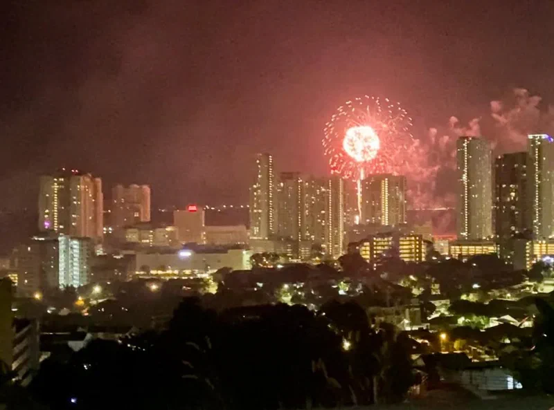
Happy New Year 2025. Wishing everyone a fabulous year ahead!

View of the spectacular Straits Quay fireworks display.

Happy New Year 2025 — image 1

https://www.eugenequah.com/blog/happy-new-year-2025/

Copyright © 2026 Eugene Quah Ter-Neng. All rights reserved.