Collectibles in the Hills
Précis
This précis was automatically generated based on the full article text.
After two failed attempts, the authors finally climbed Bukit Bakar Kapur (the old Mount Palmer). On the way down, a companion spotted a toppled stone. Hiker Heng Aik Sin poured coffee over it to make the carved letters readable: ‘TS 11’, a colonial trigonometric survey marker. They set it upright again.
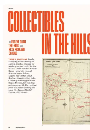
Such stones come from the great survey of Penang led by F.W. Kelly in the 1890s, which produced the most accurate maps of the century. Heng now tracks them down on peaks all over Penang. Other hikers hunt the water authority’s 35 numbered rain gauges. The retired lecturer Rob Dickinson found almost all the reachable ones between 2016 and 2019, learning along the way how they follow the catchment ridges.
A newer craze is GPS drawing: walking routes that trace shapes on a digital map. Penang trails now form a unicorn, a rabbit, a snake and a squid, and the trail runner Krystal Khaw collects them, where one wrong turn spoils the picture. Whether stone, gauge or GPS line, each ‘collection’ is a story about people and these hills.
Key points
- The triangulation of Penang and Province Wellesley was completed in 1887, and Kelly's resurvey ran from 1891 to 1893.
- Some useful old maps from GTWHI's Visions of Penang site are no longer online.
- The rain gauges help forecast water levels in Penang's dams.
- The 26 km Unicorn Trail began as a 'horse' before hikers added a horn.
- The article returns to Mount Palmer, which Eugene Quah first wrote about in February 2023.
Why it matters
It shows that history, science and creativity can all be found on an ordinary weekend hike, and invites readers to look more closely at what they pass on the trail.
- Places
- Bukit Bakar Kapur (Mount Palmer), Pulau Betong, Penang Hill, Penang
- Subjects
- trigonometric station stones, Frederick William Kelly, Heng Aik Sin, Rob Dickinson, Krystal Khaw, GPS drawing