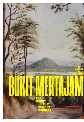
Bukit Mertajam: The Mount That Decides Borders
Précis
This précis was automatically generated based on the full article text.
In 1839 the young surveyor James Turnbull Thomson rode an elephant across Province Wellesley with his guide, Ahmad, a retired soldier, towards a great hill. At its foot he found Chinese pepper gardens and a welcoming headman, the beginnings of the town known in Hokkien as ‘Foot of the big hill’. The hill itself is probably named after the mertajam tree, a small shrub with red fruit that was used in local medicine.
For decades the hill was literally a border. Under the 1831 treaty with Siam, its western slope was British and its eastern slope Siamese. The 1869 treaty used it again as a landmark to extend British territory. The border vanished in 1909, then briefly returned during the Second World War.
On its southwestern foothills, near St. Anne’s Church, is a rock with 5th-century Buddhist inscriptions, one of which mentions a seafarer. Back then the sea reached the hill’s foot, and the site was a coastal outpost of ancient Kedah. In 1845 the official James Low carved his own name on it in Latin. To make up for it, he recorded the inscriptions and published them.
Key points
- Bukit Mertajam is 545 m high and is the source of the Juru River.
- The town was probably founded between 1834 and 1839.
- Thomson later built the Horsburgh Lighthouse off Singapore.
- By 1862 a bungalow stood on the summit as a possible 'Province Sanitarium'.
- A ritual held every ten years at the rock, involving a sacrificed bull, was reported in 1915.
Why it matters
The hill's story ties together ancient trade, colonial border-making and the growth of a major mainland town, which is easy to miss when you pass it on the highway.
- Places
- Bukit Mertajam, Cherok To' Kun, Province Wellesley, Seberang Perai, Kedah, Penang
- Subjects
- Bukit Mertajam, James Turnbull Thomson, James Low, Cherok To' Kun inscriptions, St. Anne's Church